FIG PUBLICATION NO. 50
History of Surveying
Jan de Graeve and Jim Smith

INTERNATIONAL FEDERATION
OF SURVEYORS (FIG)
|

INTERNATIONAL INSTITUTION FOR THE HISTORY OF
SURVEYING AND MEASUREMENT
FIG PERMANENT INSTITUTION |
Contents
Preface
Foreword
1. Preserving Surveyors’ Professional Heritage
1.1 Introduction
1.2 Aims
1.2.1 Studies
1.2.2 Preservation
1.2.3 Promotion of interest in
history of surveying
1.2.4 Collaboration
1.2.5 Information dissemination
1.2.6 Research
2. The Struve Geodetic Arc
2.1 Struve Arc and its way to UNESCO World Heritage Monument
2.2 Continuing Struve Arc activities
3. Other Activities, Publications and Material
3.1 Research projects
3.2 Papers and presentations
3.3 Exhibitions
3.4 Calendars
3.5 Reproduction of historical texts
3.6 The Struve volumes
3.7 Publications
3.8 The future
3.9 Administration and contacts
References
Appendices
Orders for printed copies
The history of surveying and measurement has been part of FIG
work since its establishment more than 130 years ago. This is natural
because of the role of surveying, mapping and exploring the globe since
beginning of mankind. The history was originally part of the general
professional commissions (Commission 1) and then received its own place in
the FIG structure, first as an ad hoc Commission and then as a permanent
institution of the Federation. Since its establishment the International
Institution for the History of Surveying and Measurement (IIHSM) has been
very active in organising its events, exhibitions and reprinting old books
that are relevant in understanding the history of geodesy and surveying.
The biggest result of the IIHSM has been the work on getting the
Struve Arc included in the list of the UNESCO World Heritage Monuments. Together
with authorities from the ten countries where the arc exists the long time dream
was finally recognised in 2005. This publication recognises also this work
together with other activities that the institution has managed to implement
during its more than fifteen years of history.
I would like to express the sincere thanks of FIG to Jan de
Graeve, Director of the Institution, Jim Smith, Honorary Secretary of
IIHSM and other members of the institution for all their efforts in making the
history of surveying a part of our common heritage within FIG.
Stig Enemark
FIG President
Surveying has been a focal point of evolution in technology joining
mathematical applications to innovations in mechanical engineering and
instrument construction technology.
The original aims of a couple of surveyors has been realised through the
International Institution for the History of Surveying and Measurement (IIHSM) –
Permanent Institution within FIG. Over the last 15 years we have realised
several objectives to the benefit of much goodwill from many colleagues and
mutual understanding over the language barriers.
The interest over the borders for the history of our profession has created
many local working parties and it has been our goal to prepare some links
between these local groups. Since the early 1990s we have assisted, with local
surveyors in ten countries, in the realisation of inscription of the Struve
Geodetic Arc on the World Heritage List of UNESCO and thereby making our
profession benefiting from worldwide recognition.
The aim to link the Struve Geodetic Arc with the Arc of the 30th Meridian
through Eastern Africa could help to understanding, and some day predicting, the
tectonic movements and the changes in the figure of our earth, by controlling
the protected points for the foreseeable future and to understand the
3-dimensional deformations.
The study of early surveying books can also be profitable for the future. The
Romans used different borderstones and they were linked by directions and
distances in a codescript; see for example The Ascanius manuscripts in
Wolfenbüttel of the late 5th and 6th centuries published by Galland in 1554.
Have you an instrument that visualises your survey on the land? It was
described by Master Martin in the Surveyors’ Perambulator in 1661 and a similar
instrument exists in the Deutsches Museum in Munich, and the most sophisticated
is at Leiden in the Boerhaeve Museum that was used for finalising the drawing.
With satisfaction we see that the attendances at the history workshops are
steady around 50 with a new focus and interest from African colleagues as well
as visiting non-surveyors.
We can learn from our past and today’s new technologies will be collectables
in the near future.
Jan de Graeve
Director, IIHSM
1. Preserving Surveyors’ Professional
Heritage
1.1 Introduction
The professional work in FIG is done by Commissions, at present 10 in total
and each covering a particular area of the professional interests. The other
sub-division is that of Permanent Institutions. The International Institution
for the History of Surveying and Measurement (IIHSM) is one of the two Permanent
Institutions within the FIG.
Each permanent institution has
- A director, who shall be nominated by a member association in the
country in which the permanent institution is housed. The Council will
consider the nominations for the director and submit it to a vote of the
General Assembly. The appointment of the director is for unlimited period.
- The other officers are appointed by the institution itself.
- The FIG Council will ensure that the work of a Permanent Institution
accords with the Federation’s plan of work.
- Director of the permanent institution may attend meetings of the General
Assembly and may participate in debate but shall not have voting rights; and
shall present a report on the work of their permanent institution to each
meeting of the General Assembly.
- Each permanent institution shall be responsible for its own finances and
for any expenses incurred by its director. Hence the work is sustained
either from institutional support or from any income generating activities.
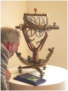
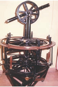
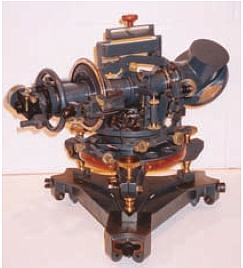
A recently re-discovered Repsold theodolite used on the Struve Arc. |
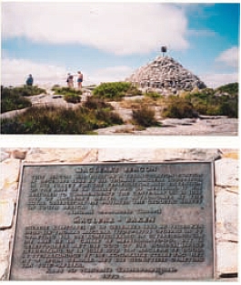
Maclear’s monument on Table Mountain, Cape Town.
|
The study within FIG of the history of surveying was started within FIG
Commission 1 from the Sofia Congress of 1983 and continued there until 1994 when
it was made an ad hoc Commission 0, later it was for a while referred to as ad
hoc Commission 11 and then in 1998 it became a Permanent Institution within FIG
and remains so to today.
It gathers together small groups of persons interested in any aspect of the
history of surveying and measurement for workshops or symposia, generally
coinciding with events of the main FIG but not exclusively so. In addition it
has mounted several exhibitions and taken on a major research project as well as
other smaller ones.
The aims of the Group for the History of Surveying were formally set out at
the FIG Congress in Melbourne in 1994 although they had been the unwritten aims
of the Group for some years before.
The aims of the IIHSM are (in edited form) as follows:
- To study: Surveyors and their work; practical geometry; and surveying
instruments and their evolution.
- To preserve: When possible preserve surveying instruments of historic
value; basic documents for identification of property; and documentation
e.g. books, manuscripts, personal notes.
- To promote: Interest in history of surveying
- To collaborate: With working parties studying parallel discipline e.g.
history of geodesy, cartography, hydrography, photogrammetry, astronomy,
mathematics; and with public authorities, institutions, museums, e.g. as
experts
- To inform: The Council of its work; colleagues during FIG meetings; the
general public by publications, reports, reprints; and the authorities by
recommendations.
The 36 inch theodolite used on the Indian triangulation. |
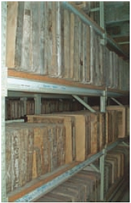
The library of litho stones in the Bavarian
State Survey Dept. Munich. |
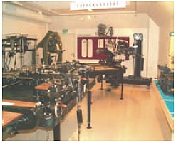
Part of the survey museum of the Norwegian Survey Dept. Honefoss. |
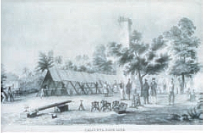
Baseline measure, Calcutta 1831–2.
|
- The achievements not only of surveyors and colleagues of great repute in
history, for instance Mercator, Euclides, La Condamine, William Roy, Everest
and Struve but the more recent colleagues and instrument constructors. The
publication Feinmechanik aus Kassel – 225 Jahre Breithaupt & Sohn is a good
example of the record of development within a major surveying instrument
firm.
- Practical geometry, other than the very recent, with the application of
integrated numerical systems, the evolution of knowledge and of the
methodology of measuring practice has been a slow evolution based on applied
geometry, trigonometry and descriptive geometry in function of the available
instrumentation.
- The evolution of surveying instruments. Today there are only a few works
on the subject. Even the theodolite, which has been THE instrument, has been
studied without a final work especially of the forerunners of the instrument
described by Digges as the instrumentum topographical, but also his
instrument called the theodolite was what is called a plane circle, a
“platkloot” in Dutch, a “cercle entier” in French or a “full Kreiss” in
German and not a theodolite. There is scope for much more to be written
authoritatively and in depth.
Early in its existence with its European colleagues the Group prepared for
Europe an international trilingual directory of places of interest for the
Surveyor: Helmut Minow. Historical Surveying Instruments – List of collections
in Europe – 1st (1982) and 2nd edition (1990). This publication details the
holdings of many of the more important repositories of old surveying
instruments. As a result of this initiative two of the larger museums have
produced remarkable catalogues and inventories.
IIn Dortmund (Germany) the German colleagues completed in 2010 the 3rd
edition of Museumhandbuch. Vermessungsgeschicte and in Cambridge (U.K.) the
Whipple Museum produced The Compleat Surveyor by Jim Bennett and Olivia Brown
and their first catalogue of a series: no. 1: Surveying.
1.2.2 Preservation
There is an urgent need to work for preservation, promotion and
collaboration. So often today one hears, too late, that this or that
establishment has jettisoned its store of old, early or obsolete surveying
instruments.
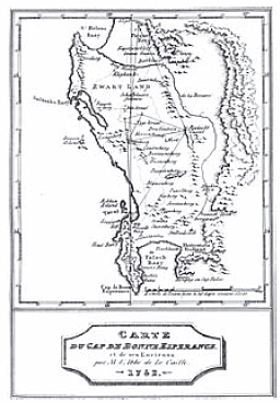
LaCaille’s Arc measure in S Africa, 1752.
|
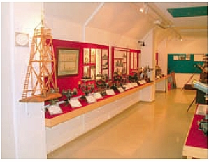
Part of the survey museum of the Norwegian Survey Dept. Honefoss. |
- The instruments of historic value. In Strasburg for example, a
Technical School – threw away a complete collection of original
photogrammetric instruments from the early 19th century, just because a
new teacher wanted space for new equipment. Despite our efforts the
whole heritage was lost! This was one of the many frustrations suffered
from time to time.
There have been some success stories, for example in the preservation of
a 16th century Arsenius Astrolabe in Paris (I.G.N.). The first
astrolabe, signed G(erard) M(ercator) of R(upelmonde)
was brought to the attention of Prof. Gerald L’E. Turner from Oxford who
attributed two more astrolabes to Gerard Mercator and the preservation
of a set of instruments of CHAROT (Paris) in the Antwerp Van Heurck
collection.
Through the careful study of instruments and of the related methodology
from historic textbooks in specialised libraries, one can link and
research the control of the results of early measurements. In addition
the degree of precision of measurements and the accuracy, resulting from
cartography can be studied but so far very little work has been done on
this topic.
- To preserve basic documentation for identification of property.
There is a role in the public interest to secure the borders of
property. This is the basic reason of the function of the “land
surveyor” from Egyptian times until today. In Eastern and Central
European countries a period of non respect of property rights has caused
great political, financial and economic trouble due to lack of this
fundamental right of property respect.
Klaus Rürup and Georg Milev presented a paper giving in detail some of
the consequences and results. The change of technology and the quick
obsolescence of technology will make it more and more important to keep
the original records and secure them for the future.
- Since Guttenberg invented the printing process in the West,
knowledge has been secured through books for future readers: verba
volant scripta manent. In addition manuscripts and personal notes of
surveyors are of utmost importance, the field books, the notebooks and
diaries of party walls, are a fundamental heritage of the surveyor, as
in some countries the official documents become unavailable due to
failures in the administrative systems.
Tartu Observatory: point O for the Struve Meridian. |
IIHSM gave help to Berres Colville during her writing of Robert
Hoddle-Pioneer Surveyor 1794–1881. |
1.2.3 Promotion of interest in history of surveying
Introducing the history of surveying should be part of the education system,
although the evolution of instrumentation has often been part of that already.
Achievements in, and the evolution of, techniques and instrumentation can
prepare any new generation to work with completely new technologies as today
where a given technology might be obsolete within 20 or 30 years.
Can readers remember that the first Hewlett Packard 65, compact computer with
programmes, was launched only in 1972 and prior to that it was necessary to use
logarithmic tables, nomograms and hand cranked calculators?
There was no (affordable) electro-magnetic distance measuring equipment
available for every survey party, until the Geodimeter and the Tellurometer were
invented within ten years of each other shortly after the War II and changed the
methodology of surveying from triangulation to trilateration.
1.2.4 Collaboration
Surveyors can act as experts together with other institutions such as
educational institutions, public authorities and museums and together with
curators take care of surveying collections.
Even now efforts are being made to gather sufficient interest and funding to
found a Museum of Map Making in the U.K. This idea has been around for many
years but there is gathering impetus now with the increasing loss of appropriate
artefacts and the loss of the dedicated land survey display at the Science
Museum in London. Many National Survey Organisations feel it to be their duty to
set up museums of their past achievements and instrumentation, but some as the
Ordnance Survey in the UK have yet to be sparked into life in this area.
In addition there can be cooperation with study‑groups in other disciplines,
working in similar fields such as the history of geodesy, cartography,
hydrography, geology, photogrammetry, astronomy, mathematics, the history of
scientific instrument societies and history of other relevant sciences. Some
already exist, for example, in the Netherlands.
As in earlier times the “Géomètre” or the surveyor was the learned man
practising all or many of these fields.
1.2.5 Information dissemination
There is also the duty of spreading information on these activities:
- Informing the FIG Council and the Congresses and Working Weeks on the
progress of the work of the Institution. This was discussed in a General
Assembly where the three possible means by which that end could be most
affectively achieved were debated. The possibilities were: a specific
commission; a task force; or a permanent institution.
- The outcome was the formation of the present Permanent Institution. The
title might imply a body with numerous paid members of staff. However, the
permanent institutions work on a voluntary basis in the same way as the FIG
Commissions.
- Dissemination of information to the general public by specific
publications and where the role of surveyors and surveying are preponderant.
An example at the time of the Melbourne Congress was: The Divide Circle – A
history of Instruments for Astronomy, Navigation and Surveying, by Jim
Bennett.
Lastly surveyors have a role in society and so often have key positions in
administrations, technical services, or government duties where our influence by
recommendation, to public authorities, will be of primary importance and
especially to give guidelines for preservation of basic documents for
identification of property and for safeguarding the instruments.
It was noted that groups studying the history of surveying already existed in
many countries for example, Germany, Belgium, France, Switzerland, United
Kingdom, the Netherlands, Australia, USA, Poland and Hungary, and interest for
the subject was acknowledged by the FIG Council.
History Workshops and/ or exhibitions have been held at most of the FIG
Congresses and Working Weeks since 1985. For the assistance of future
researchers a list of the papers presented at the above gatherings is on the
website of the IIHSM. Additionally the Group has supported various other
appropriate gatherings around the world.
At the FIG Melbourne Congress of 1994 delegates from Finland floated idea of
trying to obtain UNESCO World Heritage status for the Struve Geodetic Arc. This
is a triangulation scheme observed between 1816 and 1852 from the North of
Norway to the Black Sea. This turned into a major research exercise that was to
cover ten years of effort before it finally succeeded, see also chapter 3.1.
8 inch reflecting theodolite circa 1930. One only
of its type designed for use on the Arc of the 30th
Meridian to specifications mostly from Brigadier
Martin Hotine. In store at the Science Museum, London.
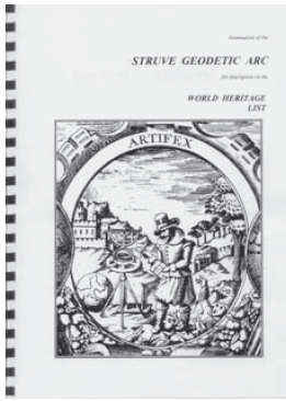
Struve submission document to UNESCO, 2004.
|
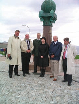
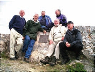
Surveyor General of Norway, Jan de Graeve, Bjorn Geirr Harsson, The
Minister of Fisheries, Jim Smith and the Mayor of Hammerfest. |
2. The Struve Geodetic Arc
2.1 Struve Arc and its way to UNESCO World
Heritage Monument
The field work on the Struve Geodetic Arc (or Russo–Scandinavian
Triangulation) was observed between 1816 and 1852. Before the end of that
century there had been several expeditions to try and trace the surviving
stations.
Aarne Veriö [1] refers to this in his paper of 1993 where it is noted that
Professor Alfred Petrelius of the Technical University in Helsinki made
systematic searches in 1886, 1888 and 1889. At that time local knowledge of the
measurement scheme still survived and he was able to draw upon some of that in
his searches. His activities were in the area from the South coast of Finland to
the northernmost point of the Gulf of Bothnia near the city of Kemi. Of the 71
stations in this section, 8 were not marked permanently and of the other 63 he
found 51.
In 1914 efforts were made by K. H. Mannermaa to find stations north of
Tornio; in 1928 by Aarne Rainesalo and later expeditions took place in 1968 and
1989 on the initiative of Seppo Härmälä who had been a Deputy Director General
of the National Board of Survey for Finland. These latter investigations were by
Aarne Veriö who found that of the 92 points on Finnish territory 8 were
undocumented (presumably the same ones as Petruvius had noted), and of the
remaining 84, 61 were found, 18 were known to have been destroyed and 5 were of
unknown fate.
All this background was brought together by Aarne Veriö in a paper produced
in 1993 for an International Scientific Conference in Tartu (formerly Dorpat),
in Estonia to mark the 200th anniversary of the birth of F. G. W. Struve and J.
H. Mädler and the 100th anniversary of E. J. Öpik. This Conference took place
from 26 to 29 August 1993.
Unfortunately Veriö was unable to present the paper because of ill health so
it was presented on his behalf by Seppo Härmälä. In his paper Veriö expressed
the importance of the 1989 expedition to preserve “one document of a past
generation’s work and international cooperation”. “We can state that these
modest holes in the rock are valuable relics, archaeological documents. In our
neighbouring countries there are some better visible monuments. The big statue
in Fuglenes in Norway is famous. In Estonia, the Struvian stations and the
impressive end of the Simuna baseline are nearly places of pilgrimage among land
surveyors.”
Although he did not specifically suggest in the paper the idea of the Arc
becoming a World Heritage Monument there was nevertheless a Resolution accepted
on 28 August 1993 “urging the governments of those countries i.e. Norway,
Sweden, Finland, Estonia, Latvia, Lithuania, Ukraine, Byelorussia and Moldavia
that still possess relics of that enterprise to take all possible steps to
preserve those relics”, including an approach to UNESCO to declare them to be
World Heritage sites (Russia was inadvertently omitted in the drafting of this
Resolution).
The Chairman of the meeting was Alan H. Batten, an astronomer from Canada,
but English by birth, who had, only a few years earlier, published a book on the
lives of some of the Struve family. [2]. That volume contains a chapter on
Measuring the Earth.
The following year FIG held its Congress in Melbourne, Australia (5–12 March
1994). There Bjorn-Geirr Harsson presented a paper [6] summarising the work of
Struve and the various phases in which it was carried out. Like the Veriö paper,
this did not contain any direct suggestion that the Struve Arc might be
submitted for inclusion on the UNESCO World Heritage List. However immediately
after the session in which Harsson gave his paper, Seppo Härmälä suggested to
Jan de Graeve, Chairperson of FIG Commission 1 that it might well be appropriate
to ask FIG to consider a resolution on this topic.
A suitable wording was agreed and the resolution put before the General
Assembly of the whole of FIG. It was duly carried as follows:
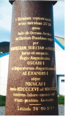
Considering
the great historical value of the measurement of the arc of the meridian,
and that an inventory exists of land monuments marking the arc of the
meridian, called Struve, which extends over 9* countries and 25º of latitude
from the Black Sea to Hammerfest situated on the north coast of Norway,
Commission 1
recommends
that FIG should present a request to the United Nations that the remains of
this arc of the meridian be added to the World Heritage List of historical
monuments.
* Note that as in the previous Resolution, Russia was
again inadvertently omitted.
A further similar resolution was passed at the General Assembly of the
International Astronomical Union (IAU) at its General Assembly in The Hague in
1994. In addition the International Association for Geodesy (IAG) also expressed
its support.
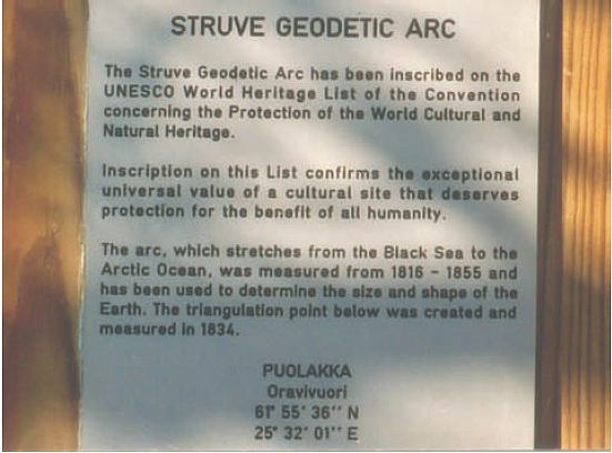
Plaque of Struve point Puolakka in Finland.
At that time, 1994, historical topics within FIG came under Commission 1 but
the IIHSM was soon to come into being. Those in Commission 1 with historical
interests took the idea up and began the prolonged efforts to get all ten
countries interested and actively working together on the project. Language
problems were only some of the many difficulties encountered in what was very
much a multi-cultural exercise.
At the FIG Working Week in Prague in May 2000 Seppo Härmälä presented a
further paper [5] in which he not only emphasised the earlier papers by Veriö
but was able to comment upon the efforts put in up to that date in endeavouring
to obtain active cooperation from all ten countries concerned. He went further
by adding:
“There is still one more aspect to be discussed. As mentioned before, the
2 tomes by Struve where the Arc was documented, belongs to the history of
surveying. It is valuable and it is interesting. Unfortunately the book is
now a rarity, seldom found in libraries. It is uncertain whether it is found
in every involved ten countries. It is true that it has been reprinted in
Russian in Moscow. No doubt that must also be out of print.
It would be a cultural achievement to reprint the tome. Still better if
it would be in English to get more readers. In French it could be a
facsimile product. Perhaps the International Association of Geodesy could
support the idea. It is worth thinking of this idea.”
The Prime Minister of Moldova with Jarmo Ratia Director General of
National Land Survey (Finland) in The Ukraine at the Monument at
Rudy in Moldova. |
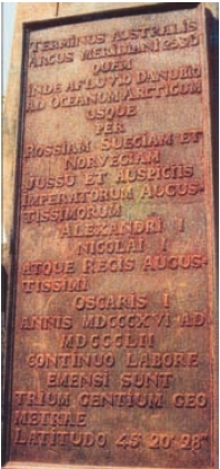
Monument inscription at the South end of the Struve arc in The
Ukraine.
|
Härmälä was hoping that a submission could be made by the end of that
year, 2000, but that was over-optimistic by 4 years.
One major problem was the fact of how different the Struve Geodetic Arc was
to any other WHM up to that time. The Pyramids, The Victoria Falls, Stone Town
in Zanzibar and the Taj Mahal for example were all features of great size, great
attraction and visible from miles away. The Struve arc to be presented to UNESCO
in 2004 was 34 points, each of a small mark in a block of stone at most about
0.5 m across, spread over 2821 kms and each only visible (if at all) when nearly
on top of it. Even when marked by a nearby monument and inscribed plaque any one
of them only occupied around a square metre.
So how could such a project qualify? In discussions with UNESCO this seemed
not to be a problem. In its favour was that the WHM would span 10 countries, a
very appealing idea to UNESCO, whereas most other designated WHMs were in just a
single country. The international cooperation over ten countries was of great
appeal. In addition it was felt that UNESCO could introduce a new category of
monument, one that related to a scientific achievement rather that of the
culturally and visually attractive sort.
In 2002 the IIHSM compiled an Interim Report of the material then available
on the Struve Arc as a means of spreading the word of its worth and of
attracting funding. Some of this material later formed part of the final
submission. However, discussions with a UK UNESCO delegate left one with no
doubt that it was a hopeless case and not worth pursuing. It is encouraging to
recall how that advice was ignored to good effect.
Pekka Tätilä, Jan de Graeve and Jarmo Ratia with the officials of UNESCO
submitting the proposal in 2004.
Since the beginning there had been a continuing, but spasmodic interchange of
information with the National Land Survey of Finland but it was at the Struve
Conference in Tallinn in 2002 that the National Land Survey of Finland took on
the massive task of compiling and printing the final documentation to be
presented to UNESCO.
On several occasions meetings were held in Brussels when a representative of
UNESCO met the Board of the IIHSM. He was knowledgeable in the techniques of
surveying and could appreciate what was involved whereas many other UNESCO WHM
delegates and staff would be from other disciplines and know little if anything
of the subject. The major unknown was to be the particular interests and
specialisations not only of the UNESCO inspectors but particularly of those who
would be doing the voting. How many of them would have any knowledge of
surveying, particularly in our case, of geodesy? There would be architects,
archaeologists, specialists in heritage protection and others but the presence
of a land surveyor would be unlikely. So it was that a major part of the
submission was a section on the “Background of the Struve Geodetic Arc” written
with the non-surveyors in mind. This set out, albeit briefly, but in simple
terms, what triangulation was, what it was trying to achieve, and the problem of
the shape of the earth. This forms the 34 page Appendix I of the submission. A
Bibliography of 150 entries at section 7(c) of the submission forms a useful
starting point for anyone wishing to pursue further research on the topic
although there have been many further papers written since that list was drawn
up in 2003.
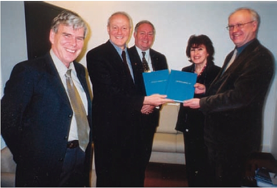
By the end of January 2004 the submission document [3] was complete and this
was presented to the Director of UNESCO by Jarmo Ratia, Jan de Graeve and Pekka
Tätilä.
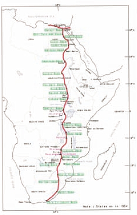
Arc of the 30th Meridian. (Courtesy of T Zakiewicz).
|
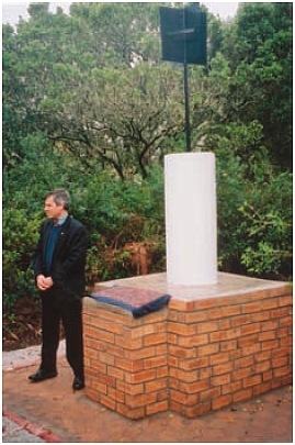
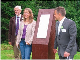
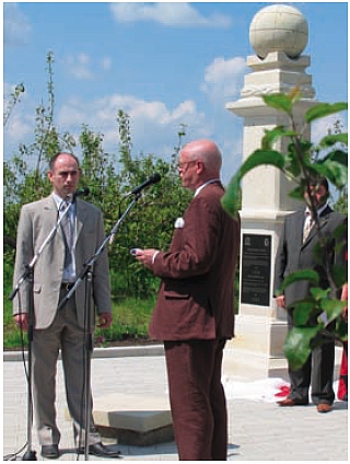
Unveiling of a plaque at the S end of the Arc of 30th Meridian at
Buffelsfontein, 2004. |
Decisions within UNESCO have to mature and are not rapid. It would be 18
months before the outcome was known. In that time inspectors appointed by
UNESCO visited all the points and had detailed discussions with many
persons. Finally at its annual meeting held in Durban, South Africa, on 15
July 2005, the vote of delegates was taken and the positive decision was
agreed unanimously.
Since the Struve Geodetic Arc was inscribed on the World Heritage List of
historical Monuments it has been pleasing to see how the local communities in
the vicinity of any of the 34 designated points have really taken the marks
under their wing and not only maintained them but promoted them. Each country
held ceremonies to “inaugurate” their points, marking some with monuments and
then improving access facilities, information boards, car parking and even
arranging that they appear on various tourist itineraries. The most northerly
point in Hammerfest, North Norway is within some few minutes walk of the ferry
terminal where many cruise ships stop. It is said that in the last year alone
100,000 visitors from such ships were able to visit the monument. Of course, at
the other extreme, some only attract a very small number of visitors because of
their remoteness.
To promote this monument in a different way a year was spent in translating
from French to English the two volumes written by Struve [4] detailing all the
work of the survey. These two volumes amount to almost 1,100 pages and are now
available in a limited edition bound in simulated leather to mirror the
original edition.
2.2 Continuing Struve Arc activities
For the future work is progressing, albeit slowly, on gathering all the
relevant information of the triangulation extending to the south of the Struve
Arc so that it might in due course by put forward as an extension to the same
World Heritage Monument. If this happens it would provide a continuous monument
from the North of Norway to near Port Elizabeth in South Africa. A span of 105º
of latitude. The survey has been achieved over many years but the difficulty is
obtaining all the information required and then getting all the countries
involved to agree to the plan.
Why the interest to extend the monument so far south? There are particular
reasons
- The survey work was done between the two Great Wars for a meridian arc
that connected with the Struve Arc in what was then Poland (now Lithuania)
and then progressed south through Rumania, parts of the former Yugoslavia,
Greece and on to Crete.
- In the 1950s the American Air Force used Hiran/Shoran to effect a
connection between Crete and the triangulation of North Africa. This joined
three points in Crete and neighbouring islands to three points on a chain of
triangulation going west from Cairo along the coast and into Libya.
- The work begun in South Africa by David Gill in the 1880s, that was to
become the arc of the 30th meridian, gradually made its way northward in
fits and starts until the mid 1950s when the AMS (US Army Map Service) made
the final connection in The Sudan that made it a continuous chain of
triangulation from Buffelsfontein near Port Elizabeth to Cairo.
- So although executed somewhat piecemeal a triangulation connection
exists between Port Elizabeth and Hammerfest where part of it consists of
much of the Struve Arc. As part of this is already designated as a World
Heritage Monument it is understood that it should be easier to extend the
monument than, for example, someone starting to promote a case for another
arc to be recognised by UNESCO.
- The problem is that it is proving very difficult to obtain any
cooperation at all from some of the 20 countries involved. In addition the
detailed records of the work between the Two Wars is proving difficult to
track down although the diagrams and coordinates still exist. Efforts are
continuing to be made and who knows, in another 10 years maybe the whole
105º of triangulation may be one, world beating, World Heritage Monument.
- This will enable by control and resurvey to quantify the evolution of
the shape of
the Earth by existing or new techniques.
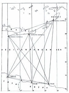
Crossing the Mediterranean Sea.
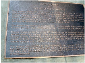
Plaque at Buffelsfontein.
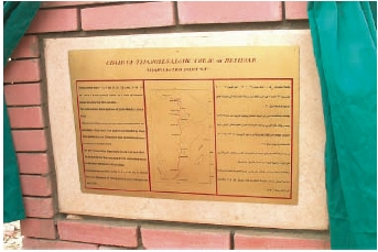
Plaque near Cairo at the North end of the arc of the 30th meridian.
3. Other Activities, Publications and Material
3.1 Research projects
- A continuing research project by Jim Smith is work on Captain Webb’s
History of Geodesy Notes. This came to light after Jan de Graeve had
visited Cape Town in 1985 and saw the mass of material available that no one
was working on. It has turned into such a large and almost open ended
exercise that it is continued as and when time allows between other
interesting projects that have occurred in the last few years.
R S Webb book.
- Jan de Graeve, (Belgium) has done extensive research into Gerhard
Mercator, the famous surveyor/cartographer, and the contents of his
library particularly in relation to the development of the Mercator
Projection. A reconstitution has been done of the scientific contents of
that library that were sold in 1604. The results of this research are
expected to appear in Le Livre & L’Estampe during 2011.
- John Brock, Australia continues his research into surveyors and
surveying activity in ancient Egypt.
- Hans-Fredrik Wennstrom, Sweden, continues his research into the
Geodimeter.
- Thomas Glatthard, Switzerland continues his collection and analysis
of texts and images about surveyors and their contribution to society in art
and literature. He has contributed papers on the topic at FIG gatherings
since the Melbourne Congress of 1994. In addition he has had several
contributions on the topic published in international journals. One such
paper is online at www.pobonline.com.
He is also Editor of the Swiss professional journal Swiss
Geomatics-Geoinformation and Land Management.
- Since the Institution was formed in 1998 personal contacts have been
established between the IIHSM and the leader of a Russian volunteer group
in St. Petersburg through Vitali Kaptüg who has researched the Struve
Geodetic arc terminal on the Russian island of Gogland and also studied
Struve’s archive in the city to identify original documents of the Struve
meridian arc measurement. The IIHSM leadership has found financial resources
to provide help to the volunteers whilst Russia was in a very hard economic
situation. The IIHSM supported:
- a memorial marking Struve’s arc points on Gogland in 2000;
- a Russian Geographical Society’s expedition to Belarus in search of
Struve arc points there in 2001;
- V. Kaptüg’s work of sorting out and indexing surviving important
manuscripts of the Struve arc measurements in St-Petersburg and Moscow
in 2002;
- V. Kaptüg’s computation positioning the Struve arc points in Moldova
and Lithuania, as well as his visit to Estonia for participation at the
1st Struve arc conference in 2002;
- V. Kaptüg’s extensive co-operation in the IIHSM’s project “Struve
Geodetic Arc” in 2002–2004.
This has resulted in:
- Russia and Belarus’s official participation in the “Struve
Geodetic Arc” project became feasible (due to restoration of
appropriate Struve stations); Lithuania has restored and included the
Struve point Beresnäki which had been recommended by V. Kaptüg; those
efforts contributed to the successful inscription of the SGA onto the
UNESCO World Heritage List in July 2005.
- A nearly full catalogue of the SGA surviving manuscripts in Russia.
The part of it relative to the Scandinavian Struve arc segments has been
recently published on the Stockholm FIG CD of the Proceedings of its
WW-2008.
- In Moldova the Struve point Dschamana near Chisinau previously
computed by V. Kaptüg was found by the Moldovans in autumn 2006.
Presently Vitali Kaptüg continues his research activities within the
St-Petersburg Society for Surveying & Mapping, and participates in regular
IIHSM workshops arranged in the frames of FIG congresses.
- Alan Wright and others, UK, continue the search for a site in the UK for
a Museum of Mapping.
- Representatives of IIHSM have given lectures on subjects related to
IIHSM for instance Jim Smith in Cape Town and Johannesburg in South Africa
and Jan de Graeve in Warsaw in Poland and in Atlanta and Arlington in USA in
2009.
- IIHSM has responded to requests from all over the world concerning the
history of surveying.
3.2 Papers and presentations
Historical papers have been presented at various FIG Congresses and Working
Weeks since September 1985.
As an aid to future researchers a list of them is given in the
appendix. An up-to-date list is also available
on the web site of IIHSM at www.fig.net/hsm.
The latest presentations are also available online.
3.3 Exhibitions
FIG Congress Toronto 1986
A commemorative exhibition has been travelling with great success to Canada
in Toronto and Quebec, to England where it was on display for two months in the
Science Museum, to Madrid in the Museo Naval, to Belgium in Liège and Gent. The
Chernobyl disaster made it not possible to exhibit it in “Lapland”.
This was an exhibition mounted jointly by the Académie des Sciences of Paris
and the FIG History Group to commemorate the 250th anniversary of the
expeditions sent to Peru and Lapland in 1736 to determine the figure of the
earth. This was a shape that had been put into doubt by the controversy between
the Cassinis in France and Newton in England. Was the earth prolate or oblate?
The latter proved to be the case.

FIG Toronto 1986 Exhibition booklet.
FIG Congress Brighton 1998
Over a period of 5 days an exhibition “The Art & History of Surveying”
was staged at the University of Brighton Gallery. Over 150 illustrations from 33
different sources were displayed on 42 panels. The whole exhibit was later put
on to a CD that was sold to raise funds for the group. It was also displayed at
several survey gatherings around the world.
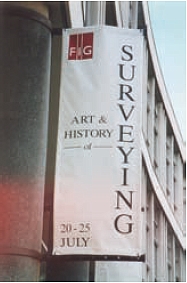
FIG Brighton 1998.
FIG Congress Munich 2006
During the period of this Congress an exhibition of historically significant
surveying texts was mounted in the library of the Deutsches Museum. A CD was
produced that gave details of each of the books together with some
illustrations. This CD was offered to all the delegates. It was also arranged
for delegates to the History sessions to see both the fine survey exhibit at the
Museum and also that within the Bavarian State Survey Dept.
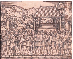
From Jacob Kobel, 1522. Von Ursprüng der Teilu(n)g…
FIG Congress Sydney 2010
A two day symposium and exhibition will be mounted at the time of the FIG
Congress in Sydney, Australia in April 2010.
FIG Working Week Rome 2012
Jan de Graeve visited Rome in February 2010 to prepare the IIHSM symposium
for FIG Working Week 2012. Mercator will also be commemorated 15 December 2012
in Belgium, Germany and the Netherlands.
3.4 Calendars
Three attempts have been made to produce and sell calendars with
illustrations of historical themes but these were of limited success in
obtaining funds for the running of the group so have been discontinued. However
the income from the calendars together with that from the reproduction books
(see below) allowed sponsorship with the Moldovan partners to research the
Struve points in that country and to sponsor exhibition in the Oxford History of
Science Museum (United Kingdom).
3.5 Reproduction of historical texts
Two surveying texts of considerable note were reproduced in the USA for
purchase.
These are:
- Geodaesia: or the Art of Surveying and Measuring of Land, made easy.
John Love, 1688. This was the first book on surveying in the Americas.
- The Compleat Surveyor, containing the whole Art of Surveying of Land.
William Leybourn, 1657.
There are still a few copies of these available for purchase.
3.6 The Struve volumes
As mentioned already, the two volumes of Struve’s Report [4] on his work have
been translated from French to English. Any one interested in these should
contact Jan de Graeve.
3.7 Publications
Among the books published by colleagues under the auspices of the IIHSM since
1985 are:
- From Plane to Spheroid. Smith J R, 1986. Landmark Enterprises.
Rancho Cordova, California.
- Mesurer la Terre. 300 Ans de Geodesie Française. Levallois J J,
1988. Presses Ponts et Chaussées and AFT. Paris.
- L’Astrolabe. Les astrolabes du Musée Paul Dupuy. R D’Hollander,
1993. Le Musée Paul Dupuy et L’Association Française de Topographie.
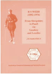
- R S Webb (1892–1976) From Shropshire to Paarl via Geodesy and Lesotho.
Smith J R, 1995. S African Council for Professional & Technical Surveyors,
Johannesburg.
- History of the Geodimeter. Smith J R 3rd Edition, 1997. Spectra
Precision, Danderyd, Sweden.
- Everest. The Man and the Mountain. Smith J R, 1999. Whittles
Publishing, Scotland.
- The Tellurometer. From Dr Wadley to the MRA 7. Smith J R, Sturman
B and Wright A F, 2009. Tellumat (PTY.) Cape Town, South Africa.
- The Art of Surveying, 2006. A CD by Jan de Graeve containing 100+
illustrations from old texts relating to surveying and related topics. The
source material is in the Deutsches Museum Library in Munich.
- The contents of Gerard Mercator’s Library. By Jan de Graeve. Le Livre
& L’Estampe 2011?
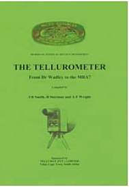
The Tellurometer. Pub 2009. |
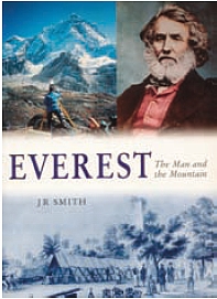
Everest – The Man and the Mountain. |
3.8 The future
Attendance at the various sessions organised by the IIHSM is open to any
interested persons. They need not be attending any FIG event to which the
sessions are attached.
Any person who has ideas for research into an aspect of the history of
surveying or measurement is welcome to get in touch and make their ideas known.
Whilst financial assistance is not very likely, help is often possible in giving
leads to both knowledgeable individuals and printed material.
Whenever it is brought to notice that important materials – whether books or
instruments – are in danger of destruction then, where possible, efforts are
made to secure their safety and this will continue.
3.9 Administration and contacts
Director of the IIHSM
Prof. Jan De Graeve
Tel. + 32 2268 1025
Fax + 32 2262 1033
Hon. Secretary
Jim Smith
e-mail jimsmith1780@gmail.com
Tel. + 44 (0)1730 262619
Deputy Director
Jane Insley
Hon. Treasurer
David Wallis
Meetings Organiser
John Brock
e-mail jb@totalsurveying.com.au
1. Veriö, A. 1994. The later phases and utilizing of the northern part of the
Struvean chain. Geodeet. Nr. 6 (30). pp. 27–30. Presented to an
International Scientific Conference in Tartu, August 1993.
2. Batten, A H. 1988. Resolute and Undertaking Characters: The lives of
Wilhelm and Otto Struve. Astrophysics and Space Science Library, D Reidel
Publishing Company, Holland
3. Nomination of the Struve Geodetic Arc for inscription on the World
Heritage List. 2004. January.
4. Struve, F G W. 1860. Arc du Méridien de 25º 20’ entre le Danube et la
Mer Glaciale mésure depuis 1816 jusqu’en 1850. 3 vol. St. Petersburg,
5. Härmälä, S. Struve Arc. 2000. FIG Working Week. Prague. May.
6. Harsson, B-G (with Chubey, M S, Kaptug, V A, Preiss G and Umarbaeva N D).
1994. The Russian Scandinavian meridian arc measurements 1816–1852. FIG.
Melbourne.
Historical papers presented at FIG Congresses and Working Weeks
since September 1985.
Copyright © International Federation of Surveyors, February
2010
All rights reserved
International Federation of Surveyors (FIG)
Kalvebod Brygge 31–33
DK-1780 Copenhagen V
DENMARK
Tel. + 45 38 86 10 81
E-mail: FIG@FIG.net
www.fig.net
www.fig.net/hsm
Published in English
Copenhagen, Denmark
ISBN 978-87-90907-81-5
Published by
International Federation of Surveyors (FIG)
Cover illustrations:
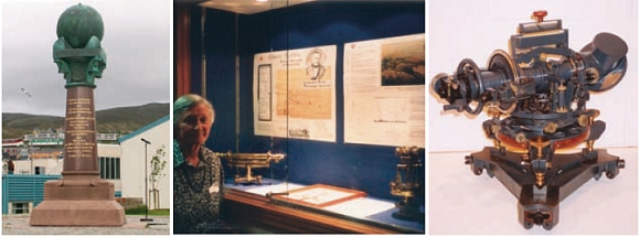
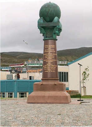
Left: Monument in Hammerfest at the North end of the Struve Arc.
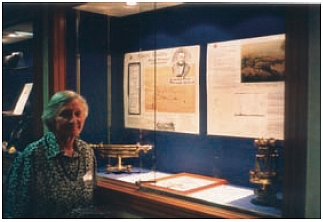
Middle: Ms. Berres Colville exhibiting at the FIG Congress in Brighton in 1998.
Right: 8 inch reflecting theodolite circa 1930 in store at the Science Museum,
London.
ACKNOWLEDGEMENTS
Editors: Jim Smith and Jan de Graeve
Design: International Federation of Surveyors, FIG
Printer: Oriveden Kirjapaino, Finland
|