News in 2015

|
Report on the Pacific Geospatial and Surveying Council Meeting and GIS /
RS User Conference
16-20 November 2015, Suva Fiji
 This report in .pdf-format
Pacific Geospatial and Surveying Council Meeting
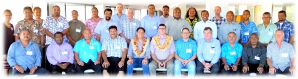 PGSC 2015 - Photo courtesy of SPC
The 2nd Pacific Geospatial and Surveying Council (PGSC) meeting was
held on the 19 – 20 November 2015 at the Pacifika Conference Room, Lotus
Building of the Secretariat of the Pacific Community (SPC) in Nubua,
Suva. The Australian Government’s Climate and Oceans Support
Program in the Pacific (COSPac) invited Rob Sarib to
represent FIG and to participate in discussions by contributing to the
development of a “strategy document” for the PGSC. Mr
Sarib was also asked to facilitate workshop sessions with
representatives from the United Nations Global Geospatial Information
Management (UN GGIM) - Dr John Dawson (also from
Geoscience Australia), and SPC Geoscience Division officers and Mr
Jens Kruger, and Ms Molly Powers-Tora.
At the first meeting of the PGSC in November 2014, Pacific Island
surveyors, hydrographers and geospatial scientists established the PGSC
and developed a Charter in response to the FIG Small Islands Developing
States (SIDs) Suva Statement on Spatially Responsible Governance.
The PGSC Charter was formulated to recognise regional challenges and the
opportunities to improve capacity building, knowledge and data sharing,
and the appreciation and enhancement of co-operation for responsible
governance of tenure of land, fisheries and forest, of geospatial (and
survey) infrastructure and information management.
To date, 11 of the 14 participating countries have endorsed the PGSC
Charter and it is expected the remaining 3 will follow in the next 6
months. It has to be mentioned that the adoption of the United Nations
(UN) resolution, initiated by the Republic of Fiji, on Global Geodetic
Reference Frame for Sustainable Development at the UN General Assembly
on 26 February 2015, may have provided the much needed political will
and momentum for this regional action.
The PGSC regional strategic planning workshop was opened with
insightful messages from Mr Faatasi Malologa (PGSC interim Chair), Mr.
Dawson, Mr. Sarib and Dr. Kifle Kahsai
(Chief Geoscientist at SPC).
The main component of the workshop discussion was skilfully conducted in
an “appreciative and participatory” manner by Ms. Powers-Tora.
This style of engagement set an informal, open, friendly and
non-apprehensive atmosphere, and was appropriate for the Pacific
community. As a consequence, this environment allowed each
delegate to actively and freely espouse their experiences, knowledge and
ideas. The questions posed to the PGSC members were as follows –
- What has worked well in support of geospatial information,
infrastructure and capacity building across the region and why?
- What resources have we got?
- What is your vision for the future of the PGSC?
- What are the steps to achieve that vision?
- How will we know if the PGSC is successful?
- As we are going along, how will we know if the PGSC is operating
well?
- At the end of 5 years, how will we know if the PGSC has been
effective?
- What are the sources of advice, networks etc can we call on to
contribute to the development of the PGSC?
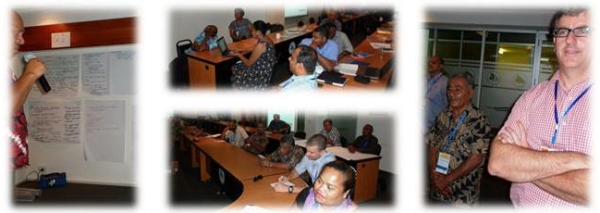
PGSC members work shopping the strategic plan
Responses from the PGSC members were then analysed and grouped which
resulted in the following preliminary strategic goals being endorsed by
the PGSC –
Strategic Goal 1
- The PGSC provides regional leadership, direction and supports members
to engage stakeholders and the community on geospatial and surveying
activities.
Strategic Goal 2
- The region adopts a modern Geodetic Reference Frame that underpins
fundamental geospatial systems and applications.
Strategic Goal 3
- Geospatial and surveying activities are supported by a diverse and
sustainable resource base.
Strategic Goal 4
- The geospatial and surveying community is self-reliant with a culture
of learning, innovation and gender equity.
There were several subsequent sessions on the development of 4-6
strategic actions for each strategic goal, and on the format or
structure of the strategy plan document. Due to time constraints,
the PGSC had to form several sub-working groups to finalise the
strategic actions, and a strategic plan working group was created to
oversee and prepare a draft strategy document. Mr. Dawson, Mr.
Sarib, Mr. Kruger and Ms. Powers-Tora were assigned to be advisors and
reviewers to this process. It is anticipated that a draft strategic
plan will be ready for review at the Christchurch FIG Working Week in May 2015.
The PGSC meeting concluded with the election of office bearers.
Both the interim Chair Mr. Faatasi Malologa (Tuvalu) and Vice Chair Mr
Paserio Samisoni (Fiji) were re-elected as the permanent occupants for
2016.
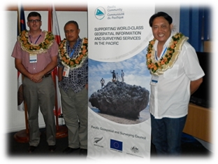
From left to right – Dr. John Dawson, PGSC Chair Mr. Faatasi
Malologa, Mr. Rob Sarib
From an FIG perspective the work done by the PGSC needs to be
applauded as the effort, the desire to succeed and the political will is
evident. The PGSC through the development of their strategy plan are
aligned with the FIG vision, and acknowledge the present FIG Council’s
theme and work-plan objectives to contribute to the global sustainable
development agenda, building the capacity of surveyors for change, and
the importance of regional collaboration. It was also apparent that PGSC
members are very much aware of the need for regional surveyors to
measure, monitor and analyse the tangible or real effects of climate
change on achieving sustainable development. For example one of the
strategic actions discussed was for the Pacific community to recognise
the present and future contribution of surveyors to manage the social,
economic, environmental and technological challenges caused by sea level
rise in the region.
Considering the above, FIG in this region is a well-respected
non-government based organisation, who has a role and responsibility for
advocating the need for professional surveyors and geospatial
scientists. To maintain and improve this profile FIG will need to
actively support the Pacific Island Countries and Territories. To
fulfil this responsibility the FIG Council and all FIG Commissions
should explore the opportunity to convene future technical workshops or
seminars or participant in relevant events to address the challenges
specific to this region. Initial discussions on such matters should
be directed to the PGSC or the FIG member association Fiji Institution
of Surveyors.
The work completed by the PGSC to date on the development of the
strategy document and related activities has been exceptional. The
PGSC members have ownership of their destiny, and realise there are
challenges which need to be considered, managed, and resolved. For
example -
- Developing timely
and effective regional work plans to manage technological, economic,
market, societal changes; and how surveyors operate and govern /
administer these changes.
- Managing increased emphasis and expectations (from users and
stakeholders) on location intelligence and land / geo-information
for decision making in sectors such as building, housing and
construction, the agricultural segment, land and marine management,
mining, environmental management, and response to disasters /
climate change.
- Developing land administration and geo-information systems, and
geospatial (geodetic) infrastructures that
- Secures land (and marine) tenure – definition and
registration of property rights / interests and supports
property market activity or development.
- Are modern but fit for purpose
- Comprise of fundamental datasets that are authoritative,
accessible, reliable (integrity), accurate, interoperable, can
be integrated, and are relevant.
- Complies with recognised standards, protocols and
approaches.
- Identifying and
prioritising the requirements to build the overall capacity of
surveyors, and to create more opportunities for gender equity.
This includes the needs of now versus the future.
- Working innovatively, collaboratively, and in a unified manner
in an environment of competing resources and agendas with various
sectors and stakeholders – government, academic, commercial and
user.
- Identifying and understanding regional and “global aid” programs
that are initiated by agencies such as - Aus Aid, NZ Aid, US Aid,
World Bank, Asian Development Bank, International Finance
Corporation.
- Building a PGSC institutional framework and work plans to
attract “aid” at a regional level.
- Building strategic alliances with existing regional
organisations in the Pacific who are experienced in the acquisition
of resource such as - Pacific Islands Forum, SPC, University of
South Pacific (USP), Forum Fisheries Agency (FFA), CROP Agencies,
Secretariat of the Pacific Regional Environment Programme (SPREP).
- Identifying and securing resources and developing “people” to
operate and administer the PGSC in the future.
- Maintaining PGSC momentum and the will to make a difference.
- Continually promoting the PGSC profile and the advocacy role in
region.
Final notes –
- Special thanks to
the PGSC Partnership desk for their administrative work and efforts at
this meeting.
- Thanks to Mr.
Kruger, Ms Powers-Tora and Mr. Andrick Lal (SPC) for being excellent
facilitators and hosts.
- Thanks to the PGSC members for their hard work and drive to
succeed.
- PGSC website -
http://gsd.spc.int/pgsc/
- Media coverage of the meeting, refer to website.
Fiji Times:
http://www.fijitimes.com/story.aspx?id=330128
Pacnews:
http://www.pina.com.fj/?p=pacnews&m=read&o=918523424564d1524d8b720e63952f

Images of Suva
GIS / RS User Conference
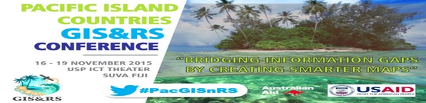
The Geographic Information Systems (GIS) and Remote Sensing (RS) User
Conference was again held at the Japan ICT Centre, University of the
South Pacific (USP). This unique symposium has been running since
1999, and was jointly sponsored by USP, SPC Geoscience Division, the
Fiji Lands Department and numerous commercial or government based
organisations or practitioners operating in the region. The theme for
conference was “Bridging the Gaps by Creating Smarter Maps”. Refer to
website -
http://gsd.spc.int/gisconference/
The conference attracted over 300 delegates from 20 plus countries.
Participants viewed and listened to over 80 presentations, attended
several technical workshops and enjoyed several tropical evening
functions. The conference convenors provided an event that
delivered knowledge, and enabled professionals and stakeholders to
engage, network, and contribute to the dissemination of regional
geo-information, applications and capacity development.
From a holistic perspective, the underlying theme for this event
seemed to focus on environmental management and the related professional
/ technical activities of surveyors. Overall there were many overview or
status presentations from the government, private and academic sectors
that related to technical issues and applications from GIS, RS,
geoscience, survey and hydrographic community. It was apparent
remote sensing or satellite based data and imagery was a major data
source to perform research, science, data / information management and
analysis in mainstream GISs.
The main observations to note where –
- The extensive use
of LiDAR, UAV technology and satellite imagery / sensors such as
Sentinel, World View.
- Several interesting technical papers on response to disasters
(such as Cyclone Pam that struck Vanuatu), and the allocation of
tasks, facilities and personnel.
- The use of GIS (primarily ERDAS Imagine and ARCGIS) and data
sources to analysis information and manage resources for
administration of coastlines, protection zones, fishing areas,
coconut plantations, de-forestation and bio-security initiatives.
- The need for integrated land information and administration
systems that can allow data sharing, assemble and interrogate other
datasets that are not directly related to the subject project.
- The need for land and marine legislation to be updated or
created that mandates the importance or management of survey,
geospatial, land, marine information (that is acts, regulations, and
policies)
- Fiji and Tonga are moving towards the adoption and
implementation of a new geodetic datum that is ITRF based.
- The status of Solomon Island’s upgrade to their hydrographic and
survey information management system.
- Vanuatu’s progress on developing their land information system
and management of government leases.
- Several Pacific countries have finalised their maritime
boundaries and lodged these declarations with the UN.
- The development of data portals such as PACGEO, and EPOG for GIS
tools.
- The need for one geodetic reference frame and vertical reference
surface for the Pacific region.
- The use of open source GIS related tools to manage information
such as OPEN FORIS, Q GIS.
- The efforts and interesting ways that many Pacific development
partners are implementing to build the capacity of the geospatial
and surveying community.
- The need to reinforce the purpose of standards, preferred
practices and protocols with respect to geo-information.
In concluding, the GIS / RS User Conferences have emerged as a
significant surveying event in the Pacific. It could be said that
the FIG Pacific South Island Development Symposium (SIDS) - Policies and
Practices for Responsible Governance in September 2013, has assisted
with the growing awareness of surveying in the region.
Nevertheless the substantial recent activity and reference to the
observations mentioned above can only highlight the potential
opportunities and need for FIG and its member associations to establish
an outreach program for the ongoing development of the professional
surveyor in this region.
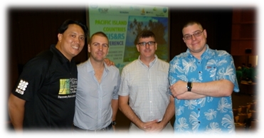
From left to right – Mr. Rob Sarib, Mr. Bart Thomas, Dr. John Dawson
and Mr. Steven Ackerly
Rob Sarib
08 December 2015


