News in 2015
|
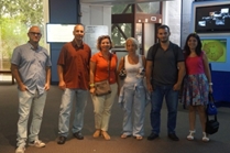
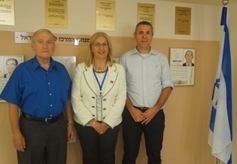
FIG president Potsiou meets with the three FIG members from Israel
6-7 September 2015, Tel Aviv, Israel
FIG President Prof Chryssy Potsiou and a team of experts from the
Laboratory of Photogrammetry of the National Technical University of
Athens (NTUA), the CERTH research Institute of Greece, and Geosystems
private company visited Israel on September 6 and 7, 2015, to report on
progress of the research study “5DMultiPurpose Land Information System
(5DMuPLIS)”. 5DMuPLIS is a joint Greek-Israel research study on
developing a technical tool for a 5D Land Information System being
performed by members of the NTUA surveying department, led by Professors
Potsiou and Ioannidis, and members of the Technion – Israel Institute
of Technology, Haifa, Israel, led by Prof Yerach Doytsher. The study and
the trip to Israel are funded by the Greek and Israeli governments. Prof
Yerach Doytsher, the President of the Israeli Association of Licensed
Surveyors (ALSI), and Dr Sagi Dalyot FIG WG 3.4 Chair on Crowdsourcing
and VGI, participated in the mission.
The first visit of the mission was to Sivan Design in Tel Aviv
(www.sivandesign.com), a consultant to the study. Sivan managers
presented the key projects of their company and discussed the
organization and products of the company and their participation in the
study.
Dr Shai Cheruti, from Sivan Design had a separate meeting with the
FIG President and emphasized the long and strong interest of Sivan
Design to support FIG Working Weeks and activities.
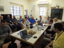
The second visit of the mission was to the Survey of Israel (SOI), a
government-mapping agency under the Construction Ministry.
SOI has approximately 250 employees and a $25 million budget. The
British Mandate established in 1920 the Survey of Palestine, which
became the Survey of Israel in 1948. The agency is made up of
professionals with 25% of employees holding masters, or higher, degrees.
Yaron Felus, Chief Scientist for SOI, gave an extensive introduction to
the agency. The meeting was attended by all directors and high-level
staff of the SOI including Dr M. Klebanov, Mr Y. Tal, Mr Y. Gavish.
One of the key objectives of SOI is responsibility over the surveying
profession including capacity, licensure and enforcement.
Research and development are included in the SOI area of activity, as
is the geodetic infrastructure of the country which includes 22
continuously operating GPS reference stations, providing a horizontal
network for access by surveyors to an accuracy of ±2 cm and a network of
vertical control bench marks.
SOI has developed a national cadaster that is 96% complete with a
registration system based on the Torrens principle wherein the state
guarantees land titles; the ministry of justice is responsible for legal
rights while SOI is responsible for title location. SOI processes about
1400 plans of subdivision, or “mutation,” annually.
SOI is moving toward a modern 3D cadaster in which property corners are
eventually to be defined by coordinates, i.e., coordinates will take
precedence over monuments or any other ground evidence in the definition
of corners. As surveyors submit their plans into the system they include
data on the survey location of points. Points are ranked as to accuracy,
Rank #1 being highest accuracy with zero error and the final official
point location definition.
SOI maintains a marine cadaster of territorial waters. It is
currently 20% complete including an agreement with Cyprus. Agreements
with Egypt and Lebanon are in negotiation, the Lebanese line in dispute
at the UN level.
SOI has been conducting a national mapping program since 1991 based on
1:40,000 aerial photography. A goal is to perform new orthophotography
campaigns annually with 25 cm resolution, eventually moving to 12.5 cm
resolution. This national mapping program includes a relatively large
number of data sets, gathered from the national ministries and has begun
gathering data from the municipalities. A goal of this program is to
make information available to citizens in an easy-to-operate system and
to make an information connection between government, citizens and the
municipalities. A National Center for Land Information will provide,
through its TopoCad portal financial, infrastructure, ownership,
planning, environmental and social data sets. A system of citizen input,
through crowd sourcing, is being developed.
One of Israel’s greatest problems is the cost of housing especially
as it affects young people. A major cause of this high cost has been
identified as a bureaucratic process that requires 12 to 15 years from
the planning stage to the sale of residential units in major projects.
In response SOI is developing a “business intelligence system” intended
to minimize the uncertainty and ambiguity of the bureaucratic process by
providing maps and reports related to large projects – 200 units or more
– that will encourage ministries to work together to eliminate
overlapping processes, uncertainty and ambiguity. This GIS platform will
be a tool for coordination showing, for instance, when a project was
initiated, its current and following stage, and all relevant information
including barriers to progress.
FIG President, the Director General of the Survey of Israel in Tel
Aviv and the President of the Israeli Association of Licensed Surveyors
(ALSI) had a fruitful private meeting on FIG issues, where Prof Doytsher
emphasized the long and strong involvement of ALSI in FIG since the
1960s, including hosting two very successful annual events - the 1972
FIG annual conference (PC meeting) in Tel Aviv and the 2009 FIG annual
working week in Eilat. Prof Doytsher expressed the continued commitment
of ALSI to FIG. Prof Doytsher has been long active in FIG, first as FIG
Com7 and Com3 delegate for many years, then as FIG Com3 WG chair and
chief editor of FIG Com3 peer review system (2007-2010), FIG Com3 chair
and ACCO representative at the council (2011-2014), and currently as the
chair of the FIG Task Force to investigate the need for establishing a
peer-reviewed FIG journal. He has been a leading professor and served in
senior management positions at the Technion, modernized the
undergraduate and graduate programs (from pure Geodetic Engineering to
modern Mapping and Geo-Information Engineering), supervised 60 Masters
and PhD students, and is the author and co-author of about 300 papers
and FIG publications.
Mr Ronen Regev also emphasized the long involvement of the SOI in
FIG. Special reference was made on the contribution of the SOI and its
former Director General Mr Haim Srebro, well-known FIG delegate of Com1,
to the recent FIG publication 59 on International Boundary Making, and
their strong commitment to continue to support the FIG Work Plan by all
means.
The final visit was to the Technion – Israel Institute of Technology
campus at Mt Carmel, Haifa. The head of Technion’s mapping and surveying
program, Prof Sagi Filin, delivered a thorough review and explanation of
the program followed by a visit to the Technion’s visitors center. The
Mapping and Geo-Information Department at the Technion is an academic
member at FIG for many years and is the only academic program in Israel
in surveying and mapping which is a prerequisite to become a licensed
surveyor. The current number of students in the program is about 170
undergraduates and 60 Masters and PhDs (at the Technion’s campuses in
Haifa and Tel-Aviv).
At the Technion’s visitors center a presentation was made reviewing
the history of the University and descriptions of several projects that
have been honored at several levels including the three Nobel Prizes
for
science awarded in the past decade to Distinguished Professors Avram
Hershko, Aaron Ciechanover and Dan Shechtman.
The group of experts also visited the Bahai gardens in Haifa and the
historic city of Jerusalem.
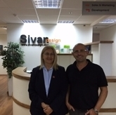
FIG President Chryssy Potsiou and Dr Shai
Cheruti, SIVAN Design |
|
Prof Yerach Doytsher, Chryssy Potsiou and Mr
Ronen Regev |
Chryssy Potsiou, FIG President
25 September 2015