News in 2023
|
Romanian Geodesy Week
Date, May, 2023, Oradea, Romanian
FIG Vice President Kwame Tenadu Snr attends the Romanian Geodesy
Week in Oradea, Romania
The fourth edition of “Romanian Surveying Week”
(RSW), the most important Romanian surveying community engagement was
held in Oradea – Băile Felix, between the 10th and 13th of May,
2023. The surveying week also marked the convening of the
general assembly of Council of European Geodetic Surveyors (CLGE) as
part of the program. Superintending the GA was the President of CLGE
Vladimir Kruppa and his Executive Council Members. The GA of CLGE made
references to the Bucharest Declaration which is published at its
website. They also discussed the IPMS Standards and the European Real
Estate standards and its value to the profession. The GA reiterated its
continued support to Ukraine through its representative and assured the
Turkish delegation of the creation of a fund for its members Turkey. The
GA also outlined some of its future activities key amongst them is the
project of blue surveying and the code of professional qualifications in
Europe. FIG was invited to attend the proceedings and I, on behalf of
Council, offered our fraternal greeting form the President and Council
of FIG recognizing the existing cordial relationship and collaboration
between the two organisations.
 |
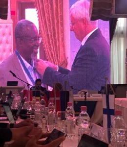 |
FIG Vice President Kwame Tenadu addressing the GA and receiving CLGE pin from
President Kruppa
Romanian Surveyors Union and University of Oradea - Faculty of
Constructions, Cadastre and Architecture invited the President AND Vice
President Kwame Tenadu of FIG respectively to participate virtually and
in person at the international conference with the theme “Modern
surveying technologies for 3rd millennium”. Special guests also came
from National Agency for Cadastre and Land registration (ANCPI),
the Council of European Geodetic Surveyors (CLGE) and the Private
Surveyor Association (APCGC). Remarks and a goodwill message were
offered by Diane Dumashie (PhD), President of FIG, outlining the roles
of surveyors as well as FIG’s determination to steer the community of
Surveyors to confront the global challenges.
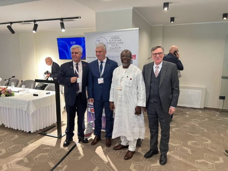
L-R Orhan Ercan, Mircea Afracinea, Kwame Tenadu, Prof. Petre
Drogomir
VP Kwame Tenadu presented his keynote focused on “PROFESSIONAL
SOCIETY’S ROLE IN THE GEOSPATIAL ECOSYSTEM” bearing in mind the
space place of the 3rd millennium surveyor leading in frontier
technologies such as Cloud, Artificial Intelligence and machine
learning, Blockchain, Augmented and virtual Reality, the internet of
things (IOT), Digital Twin, Engineering technologies: BIM, Digital
Engineering, and System Integration, GIS and Spatial Analytics, GNSS and
Positioning, Lidar, 3D, Drones. Etc
He also noted the broader user spectrum of geospatial technologies
principally, end users in the Banking, Finance, Securities and Insurance
space, Supply Chain, Infrastructure, Construction, Municipalities and
Cities, Transport and Mobility, Tourism, Health, Water, Sanitation,
Environment and Climate, Telecommunications, Energy, Petroleum, Mining,
Public Safety.
The VP cited a 2022 report by geospatial world predicting “the global
geospatial market as forecasted to be USD 681 billion in 2025 The market
is estimated to grow at a much faster rate post-2025, making it USD 1.44
trillion by 2030, on the backbone of strategic public policy reforms,
industry acceleration strategies, and innovations in the digital twin
and metaverse paradigm”. This according to him was a major imperative
for the 3rd millennium surveyor to lead and steer global efforts in the
geospatial ecosystem.
Other speakers drawn from the National Cadastre and land registration
(ANCPI), discussed the progress made by extending the
land registration and recordation program across the country and signed
a memorandum of understanding with the surveyor’s association (UGR) for
further collaboration. Whereas Professor Orhan Ecan, former VP of FIG,
related the interconnectedness and connectivity of geospatial data from
the perspective of the legal, economic, societal, environmental and
technological spheres calling for a balance between the economy and
ecology. The dean of the Oradea Notaries also made remarks on the
collaborations existing between UGR and its members.
FOCUS
The Conference technical papers and presentations focused mainly on
topics drawn from a broader area to include: Geodesy, Photogrammetry,
Remote Sensing, Cadastre and Land Registry, Applied engineering in the
fields above
A major outcome of the conference offered participants the
opportunity to present papers, debate and communicate in a professional
and scientific manner, highlighting their own contribution, finding out
smart technical solutions in order to protect, restore and promote
sustainable use of terrestrial ecosystems in the modern and challenging
transforming society and in line with the United Nation’s global goals.
Additionally, roundtables and fora on Romanian surveying education
and the evolution of the prime meridian , annual meetings and social
activities were all organized to spice the Romanian Surveying
Week in Oradea – Băile Felix. These created the professional
framework and environment for discussions, exchanging knowledge and
experience among surveyors of all ages and expertise participating in an
international event and dealing with topics in their daily activity. The
event was both on-site and on-line participation to offer participants
flexibility in participating.
A technology exhibition of innovative surveying software and hardware
also featured at the program.
FOCUS ON YOUNG ROMANIAN SURVEYORS
The young surveyors and a team led by team led by Zifceac Iaroslav
organized the “Map With Us” competition. The "Map with Us" mapathon made
a significant impact on the surveyor community, providing students and
young people the opportunity to practice their skills, showcase their
creativity, and contribute to the creation of accurate and updated
digital maps. Winning the I and II awards represents a great achievement
for the student team from #TUIASI - Faculty of Hydrotechnics, Geodesy
and Environmental Engineering
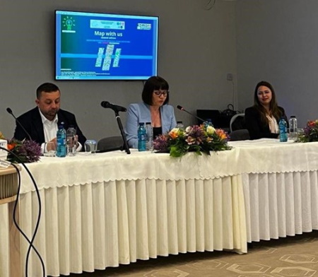
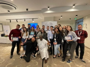
Map with us
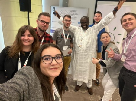
A group photo with young students and surveyors of UGR -Romania
#TUIASI #UGR #HGIM #SGR
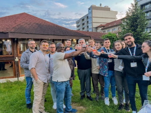
Photo gallery
Group photo with young Romanian surveyors
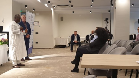
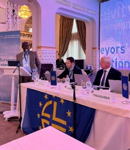
Addressing one of the sessions
FIG Vice President Kwame Tenadu Snr
June 2023