| |
FIG PUBLICATION NO. 62
Ellipsoidally Referenced Surveying for Hydrography
FIG Commission 4
Jerry Mills
David Dodd
The hydrographic surveying community is using high-accuracy Global
Navigation Satellite System (GNSS) positioning techniques for vertical
positioning of survey platforms, the sea surface and the sea floor. This
method of hydrographic surveying is known as Ellipsoidally Referenced
Surveying (ERS). ERS provides a direct measurement of the sea floor to the
ellipsoid, as established by GNSS observations, and a translation of the
reference from the ellipsoid to the geoid and/or a chart datum. In order to
meet required vertical positioning standards, it is of paramount importance
that the entire ERS process be thoroughly understood and that the
appropriate procedures are in place during data acquisition, validation,
cleaning and processing phases.
Many of the groups using ERS techniques have developed their internal
Standard Operating Procedures (SOP) through in-house experience and
trial-and-error testing. It is this wealth of group information that is being
drawn upon to help develop a set of “best practices” for the hydrographic
industry. The development of ERS best practices is being conducted by
International Federation of Surveyors (FIG) working group 4.1 under Commission 4
and will be shared with the IHO for possible inclusion in International
Hydrographic Organization (IHO) publication C13, Manual on Hydrography. I would
like to thank our working group chair, Mr. Jerry Mills, for leading this work
and the working group technical lead, Dr. David Dodd, who was solely responsible
for communicating with the various contributing organizations, collating their
comments and developing the majority of the manuscript. This is a significant
contribution of these geomatics professionals to the wider objectives of the
international hydrography community, and as well to those of the FIG.
Dr. Michael Sutherland,
Chair, FIG Commission 4
Preface
This document has been developed from contributions from many hydrographic
organizations around the world and aims to provide a background that can be
utilized by hydrographers to establish best practices for ERS. It looks at the
relative importance of all of the vertical components associated with ERS,
including; GNSS-based positioning of the antenna, translation of antenna
position to the survey platform reference point per rigid body motion, and the
application of heave and dynamic draft. Also discussed is the development of
vertical-datum separation models used to translate the ERS information to other
datums, such as a geoid and a chart datum. Ten case studies are included to
provide examples of how different groups are using ERS. The final chapter of the
document provides a summary of the recommended best practices that the
hydrographic surveying community use for success in ERS work.
The Working Group is deeply indebted to the following organizations which
assisted in compiling this document and their assistance is gratefully
acknowledged:
- The Canadian Hydrographic Service (Service Hydrographic du Canada)
- The Swedish Maritime Administration
- The US National Oceanic and Atmospheric Administration (NOAA)
- The US Naval Oceanographic Office
- The Royal Australian Navy
- State Port Operators- Maritime Safety Queensland – Australia
- The United Kingdom Hydrographic Office
- The Netherlands Hydrographic Office
- Service Hydrographique et Oceanographique de la Marine (French
Hydrographic Office)
- Centro de Hidrografia da Marinha (Brazilian Navy)
- Instituto Hidrografico – Portugal
- Danish Maritime Safety Administration
- Finish Maritime Administration
- David Evans and Associates
- Fugro Geoservices
- Fugro-Pelagos.
Special thanks are given to CARIS, the University of New Brunswick (Ocean
Mapping Group) and the University of Southern Mississippi (Hydrographic Science
Research Center) in recognition of their financial support.
The following individuals are acknowledged for their responses to working group
inquiries and questionnaires which became the basis for the material in this
document:
Stage 1 (Original contributors, 2009)
- Allen, C., G. Rice, and J. Mills. Personal Communication. US National
Oceanic and Atmospheric Administration (NOAA)
- Arroyo-Suarez , E. Personal communication. US Naval Oceanographic Office
- Bartlett, J. Personal communication. Canadian Hydrographic Service (CHS)
Central
- Battilana, D. Personal communication. Royal Australian Navy
- Church, I. Personal communication. The University of New Brunswick (UNB)
- Godin, A., D. Langelier, A. Biron, C. Comtois, F. Lavoie, and D.
Lefaivre. Personal communication. Service Hydrographic du Canada, Quebec
- Gourley, M., A. Hoggarth and C. Collins. Personal Communications. CARIS
- Hare, R. Personal Communication. Canadian Hydrographic Service, Pacific
- Moyles, D. Personal communication. Fugro-Pelagos
- Olsson, U. Personal communication. Swedish Maritime Administration
- Parsons, S., G. Costello, C. O’Reilly and P. MacAulay. Personal
communication. Canadian
Hydrographic Service, Atlantic
Stage 2 (Questionnaire respondents, 2010)
- Bartlett, J. Canadian Hydrographic Service, Central
- Dorst, L. Netherlands Hydrographic Office
- Elenbaas, B. US Naval Oceanographic Office, Joint Airborne Lidar
Bathymetry Technical
Center of Excellence
- Hocker, B. David Evans and Associates
- Jayaswal, Z. Australian Hydrographic Office, Royal Australian Navy
- Manteigas, L.P. Instituto Hidrografico – Portugal
- Moyles, D. Fugro-Pelagos
- Parker, D. United Kingdom Hydrographic Office
- Pastor, C. Fugro Geosservices
- Pineau-Guillou, L. Service Hydrographique et Oceanographique de la
Marine (French
Hydrographic Office)
- RAMOS, A.M. Geodesy Division, Centro de Hidrografia da Marinha,
Brazilian Navy
- Riley, J. US National Oceanic and Atmospheric Administration
- Scarfe, B. University of Waikato, New Zealand
- Solvsten, M. Danish Maritime Safety Administration
- Varonen, J. Finnish Maritime Administration
Jerry Mills, Chair, FIG Working Group 4.1
Dr. David Dodd, Technical Lead, FIG Working Group 4.1
Read the full FIG Publication 62 in pdf
Copyright © The World Bank and the International Federation
of Surveyors (FIG) 2014., May 2014
All rights reserved
International Federation of Surveyors (FIG)
Kalvebod Brygge 31–33
DK-1780 Copenhagen V
DENMARK
Tel. + 45 38 86 10 81
E-mail: FIG@FIG.net
www.fig.net
Published in English
Copenhagen, Denmark
ISSN 1018-6530 (printed)
ISSN 2311-8423 (pdf)
ISBN 978-87-92853-09-7 (printed)
ISBN 978-87-92853-16-5 (pdf)
Published by
International Federation of Surveyors (FIG)
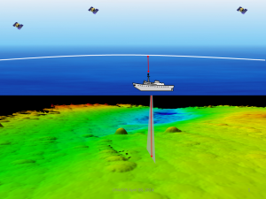
Cover images: David Dodd
Design: International Federation of Surveyors, FIG and Lagarto
|