News in 2016

|
FIG Asia Pacific Capacity Development Network Report on Activities in
the Pacific Region – November / December 2016
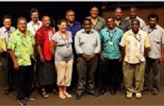
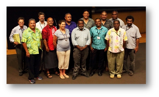
Pacific Geospatial and Surveyors Council (PGSC) Meeting
The FIG Asia Pacific Capacity Development Network (FIG AP CDN)
participated in the 3rd Meeting of Pacific Geospatial and Surveyors
Council, which was convened in Nabua - Suva, Fiji on the 24-25 November
2016 at the Pacific Community “Pasifika Conference Room”, Lotus
Building. Meetings of this nature, as well as technical projects, have
been support by regional developing partners as shown below. FIG
have been actively involved in geospatial infrastructure matters in this
region since the FIG 2013 Small Island Developing States (SIDS)
symposium by attending conferences in region, providing independent
technical and administrative advice to the PGSC, and advocating the
importance of geospatial professionals and surveyors.

At this meeting, there were 13 Pacific Island member countries in
attendance, and also representatives from agencies such as Geoscience
Australia, Land Information New Zealand, Geoscience Division of the
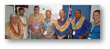
Pacific Community, and the UK Hydrographic Office. FIG had two
officers present, Mr Mikael Lilje (Vice President Elect 2017-20) and Mr
Rob Sarib (Chair AP CDN), and Dr John Dawson representing the UN GGIM
AP.
To begin proceedings, Professor Michael Petterson (Director of
Pacific Community Geoscience Division), and Mr Raymond Bojczuk (First
Secretary, Australian High Commission, Suva) delivered inspirational
presentations to the PGSC. Both speakers emphasised the value and
importance of geospatial and survey information, and also the role of
the PGSC to address the economic, social and technological challenges
faced by Pacific Island nations.
After the several addresses offering support and encouragement from Mr
Lilje, Dr Dawson and PGSC Chair Mr Faatasi Malologa (Director of Tuvalu
Lands & Survey Departments), work to finalise the content of the
“Pacific Geospatial and Survey Strategy” began. Refinement of the
strategy continued for the next two days, and it was subsequently
endorsed by the PGSC. Discussions in relation to the strategy and
its formalisation were facilitated by Mr Jens Kruger, Dr Dawson, Mr
Sarib and Mrs Molly Powers-Tora.
The remainder of the meeting was spent workshopping the detail plans
for the implementation and communication of the strategy, and the
official launching of the strategy for mid-2017. Four PGSC working
groups were then created to examine and prepare actions for 2017 against
each of the four strategic goals and their activities.
Chair Mr. Malologa and Vice Chair Mr Paserio Samisoni (Fiji) were
re-elected as the office bearers for 2017.
For on-line news articles about PGSC and their strategy please refer
to –
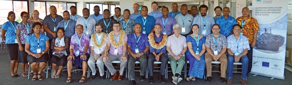
Pacific Heights Datum Workshop
At the request of the PGSC, FIG AP CDN and the UN GGIM AP were asked
to prepare an interactive workshop on Pacific height datums, and the
related practical height survey issues or problems. The one day
workshop was held at Pacific Community “Pasifika Conference Room”, Lotus
Building in Nabua – Suva on the 26 November 2016, and it attracted 30
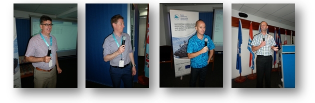
registered participants. Presentations on the following topics were
provided –
- The Importance of Height – Dr John Dawson
[Handouts]
- Heighting Fundamentals and Ellipsoidal Height System – Mr Nicholas Brown
[Handouts]
- Bathymetry and Vertical Datums – Mr David Mundy
[Handouts]
- Geoid and Vertical Datums – Mr Matt Amos
[Handouts]
To engage the delegates on the topics and related challenges,
discussions with participates and presenters after each session were
convened, and facilitated by Mr Sarib. From this workshop activity the
FIG AP CDN and UN GGIM AP developed a summary with a series of
recommendations for consideration, and they are as follows –
- It was suggested that Pacific countries need to articulate a
business case to obtain the “political will” for vertical surface
infrastructure development. For example the plan could explain
“why” vertical surfaces (heights) are important geo-information, and
that they assist with existing government development plans with
respect to the administering of the coastal zone (intertidal zone),
marine cadastres, management of flood mitigation, inundation, height
data integration, interoperability with other data and land
information systems, off shore mineral activity, land use planning
etc
- It was suggested that Pacific countries must engage with “users
/ stakeholders” to discover what vertical surfaces are pertinent to
their needs; what the present and future primary uses / applications
of a vertical surface; and what are the accuracy requirements and
specifications for each vertical surface identified.
- It was suggested that Pacific countries should consider a “fit
for purpose” approach when selecting the appropriate vertical
surface as datum. In other words have a development plan that
meets the needs of today and allows the system to be improved
incrementally.
- It was suggested that the Pacific region consider adopting an
“ellipsoidal” vertical reference surface to monitor and evaluate
regional and inter-country environmental changes and to also achieve
regional interoperability of “fundamental” datasets – such as the
cadastre, water, imagery, topographic etc
- It was suggested Pacific countries consider adopting a “mean
seal level” surface for their local reference and / or working
vertical surface.
- It was generally agreed that it was important for the Pacific
countries to model or determine the relationship / linkage between
the various vertical surfaces and datasets, that is the land, water
and ellipsoidal / reference frame. It was then generally
agreed that this was to be achieved using separation models (such as
a geoid) based on gravimetric, geometric or combined information.
- It was recommended that Pacific countries begin to discover and
audit their vertical surface data – which includes validating,
cleansing, and ascertaining the quality (uncertainty or accuracy) of
terrestrial levelling networks, tidal information, gravity
observations, elevation models, and GNSS observations on known
points of height.
- It was suggested that Pacific countries consider “digitising”
their vertical surface data into an appropriate format so that it
can used in the determination of geoids, in any datum modernisation
rigorous adjustments, and also geospatial databases. (Note the data
format will depend on the survey or processing software /
application being used)
- It was suggested that Pacific countries consider perform
necessary field observations (GNSS or terrestrial) to establish (or
confirm) connections between the different vertical surfaces.
- Pacific countries confirmed that datum modernisation not only
involves horizontal co-ordination, it also involves vertical
measurements, relevant transformation and geoid models and the
importance of metadata and standards.
- It was suggested that Pacific countries should consider what
regional projects (or infrastructure) can assist with the
development of a vertical reference system for the region, such as
gravity measurements / observations, GNSS tide buoys, mobile or
portable tide gauges, more GNSS CORS, densification of terrestrial
levelling networks etc.
- Pacific countries confirmed the importance of working
collaboratively, the sharing of data and resources, and exchange of
experiences.
- It was suggested Pacific countries use the PGSC to approach
other government agencies from neighbouring countries in the region
for technical assistance.
Pacific GIS / RS Users Conference
As per previous years the Pacific Geographic Information Systems
(GIS) and Remote Sensing (RS) User Conference was held at the Japan ICT
Centre, University of the South Pacific (USP). The technical
sessions spanned over 4 days and concluded with 1 day of workshops.
According to the organisers the event had almost 300 registered guests
and nearly 80 presentations.
FIG were involved at this event by chairing technical sessions, and
contributing two presentations namely –
- “Cooperation is the key, FIG can facilitate” – Mr Mikael
Lilje
- “FIG Capacity Development Network Asia Pacific” – Mr Rob
Sarib
Presentations can be view at websites –
http://gisconference.gsd.spc.int/index.php/agenda-2015/presentations-2016/day-1-presentations
http://gisconference.gsd.spc.int/index.php/agenda-2015/presentations-2016/day-2-presentations
Highlights or main observations from the conference were –
- The reliance on remote sensing data such as satellite imagery,
and airborne multi sensor technology.li>
- The use of open source GIS in combination with “COTS” to do
manage data and information.
- Although “internet of things”, “cloud computing” and online
computations are global trends in the GIS, for the Pacific region
this type of digital infrastructure and supporting communication
networks are not well developed to facilitate implementation.
- The release of the Fiji’s new land information portal
“Vanua-GIS” which allows users to access a variety of datasets from
various government organisations
- The use of UAVs for various applications
- The impacts of “Cyclone Winston” and how geospatial information
was used to “build back better”
Rob Sarib
22 December 2016