News in 2017

|
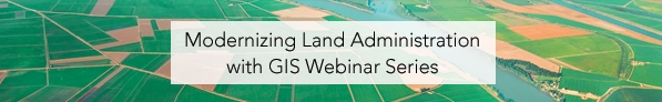
Attend one of the FIG/ESRI Webinars: Modernizing Land Administration
18 October and 27/28 November 2017
Get the experts right to you
FIG and our platinum corporate member ESRI invite you to join us for
an educational webinar series highlighting special topics in GIS for
land administration. Whether you are working with a new or
fit-for-purpose cadaster system, or are fully equipped with the latest
capabilities, these webinars will update you on current technology and
give you a clear path forward.
The two webinar are held at different times of the day in order to
make it possible for you to paricipate in at least one of the webinars.
Each webinar is sceduled to one hour, and is a unique opportunity for
you to be updated with the latest knowledge in a short time without any
travelling costs.
Webinar 1: Getting Started with Fit-for-Purpose Land Administration
Android Phones, High Accuracy GPS, and GIS
Wednesday, October 18 | 9:00 a.m. – 10:00 a.m. (EDT), equivalent to
2:00 p.m. - 3:00 p.m. (UTC)
Configurable off-the-shelf spatial technologies are now available for
fit-for-purpose cadastral systems. There is no longer a need for custom
programming, complex implementations, and special skills. Leveraging
standard data models such as the Land Administration Domain Model (LADM)
and commercial off-the-shelf (COTS) GIS data and technology deliver
systems that are quickly implemented, secure, scalable, evolve with
changing requirements and supported by numerous public, private, and NGO
communities. Attend this webinar, see sample implementations, understand
the capabilities, and learn how to get started.
Register now for
the first webinar in our series that will explore how COTS technologies
are revolutionizing fit-for-purpose cadastral systems through
automation. We hope to see you there.
Webinar 2: Modernize Your Land Administration System
Off-the-Shelf GIS Technology for Modern Cadastral Operations
Monday, November 27 | 8:00 p.m. – 9:00 p.m. (EST) equivalent to
TTuesday November 28 | 1:00 a.m. - 2:00 a.m. (UTC) and 9:00 a.m. (China
time)
Gone are the days of building highly customized cadastral systems
with siloed disparate technologies. They’re too expensive to
maintain and they don’t keep up with all the new capabilities that GIS
provides. ArcGIS is a complete, interoperable, open, and
purpose-built system for cadastral operations to improve efficiency,
manage data integrity, and share data across your organization and with
the public. Whether you aim to improve data quality, increase
throughput, or improve spatial accuracy, become more transparent - the
ArcGIS platform delivers necessary capabilities. Attend this
webinar to learn the capabilities, and how to get started.
To register
To register please go to the online registration. Here you can choose which webinar you would like to attend
Louise Friis-Hansen
14 October 2017