FIG Commission 5
|
Work Plan 2003-2006
 Original work plan in .pdf-format (as adopted by
the General Assembly in Washington, DC in 2002).
Original work plan in .pdf-format (as adopted by
the General Assembly in Washington, DC in 2002).
Title
Positioning and Measurement
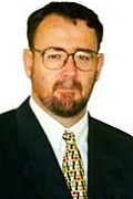 Mr. Matt Higgins, Chairperson of Commission 5
Terms of reference
- The science of measurement (instrumentation, methodology and guidelines)
- The acquisition of accurate and reliable survey data related to the
position, size and shape of natural and artificial features of the earth and
its environment and including variation with time.
Mission statement
- Focus on modern technologies and technical developments and assist
individual surveyors, through guidelines and recommendations, to choose and
utilise those methods, technologies and instruments that are most appropriate
to different applications.
- Follow technical developments through collaboration with other FIG
commissions and other international organisations; participation in
appropriate meetings; and the preparation of appropriate publications.
- Support research and development and stimulate new ideas in the fields of
expertise represented within the commission.
- Collaborate with manufacturers on the improvement of instrumentation and
associated software.
- Present and promote the work of the commission and its working groups on
an on-going basis at FIG working weeks and other relevant technical meetings
and in appropriate FIG and other media.
General
This work plan covers the development, use and integration of technologies
for positioning and measurement and the associated standardisation, best
practice and fundamental reference frame issues. Many of the issues are global
in nature and Commission 5, working with like-minded Sister Associations, is
well placed to deal with them. FIG Council has also asked the Commissions to
cooperate with United Nations Agencies to address global problems such as
sustainable development and humanitarian needs. The disciplines covered by
Commission 5 are at the heart of delivering solutions for the spatial aspects of
these important global problems. Specific activities aimed at developing
countries include examination of Low Cost Surveying Technologies and
contribution to appropriate Continuing Professional Development programs.
Working Group 5.1 - Standards, Quality Assurance and Calibration
Policy Issues
- Influence the development of standards affecting positioning and
measurement instruments and methods, in collaboration with the FIG task force
on standards and through participation in the relevant technical committees
(TCs) of the International Standards Organisation (ISO) and other appropriate
bodies.
- Acceptance controls, quality assurance and certification and their impact
on the surveying profession.
- Checking and calibration of measuring instruments.
- Assist other Commission Working Groups to implement Standards from ISO
TC211 as appropriate.
Chair and Members
Chair
- Rudolf Staiger (Germany), e-mail:
rudolf.staiger[at]uni-essen.de
Core members
- Helmut Woschitz (USA)
- Hans Heister (Germany)
Reference Group Members
- Jean M. Rueger (Australia)
- James Kavanagh (RICS, United Kingdom)
- Takao Seto (Japan)
Specific project(s)
- Present and promote the use of standards and guidelines to the surveying
community.
- Establish guidelines and recommendations for the checking and
determination of field accuracy of total stations, digital levels, laser
planes, etc and for their calibration, including lab calibration.
- Review the situation with GPS/GNSS in relation to Standards, Quality
Assurance and Calibration.
- Develop guidelines and recommendations relating to the ISO Guide to
Uncertainty of Measurements.
- Review Standards coming from ISO TC211 for relevance to Positioning and
Measurement.
- Represent Commission 5 on the FIG Standards Network (led by Commission 1).
Workshop(s)
- Participation in FIG Working Weeks and other major Commission events (see
events section below) with dedicated Technical Sessions and/or Workshops as
appropriate.
- Participation in appropriate events of Sister Associations, ISO etc
related to Standards, Quality Assurance and Calibration.
Publication(s)
- FIG Working Weeks will include Technical Papers on specific issues and
presented by Working Group Members and other invited experts.
- Continue publication of the series of Guidelines on Surveying Instruments;
including publication on the Commission web page.
- Working group final report will be presented at FIG Congress, 2006.
Timetable
- Draft publications will be presented at FIG Working Weeks during the term
of this plan and according to a timetable to be developed by the Working Group
Chair.
- Working group final report: dedicated session, FIG Congress, 2006.
Beneficiaries
- FIG member associations, manufacturers and users of survey equipment,
governments, standardisation organisations, decision makers, GIS developers
and users, surveying businesses, individual surveyors.
Working Group 5.2 - Reference Frame in Practice
Policy issues
Policy Issues include the following:
- Work to bring together all organisations involved in defining or using
reference frames to develop common approaches and avoid duplication. Such
organisations include FIG, IAG, ISO, groups of national mapping agencies,
other influential national agencies (such as the US DoD's NIMA) and alliances
of commercial organisations (such as Open GIS Consortium and the European
Petroleum Survey Group).
- Provide background technical information on relevant issues written in a
way that is accessible to the surveying practitioners.
- Develop an inventory of approaches to reference frame issues in different
countries (including transformation methodologies) that is accessible to
surveying practitioners.
- Examine how surveying practitioners are changing how they access the
reference frame, through less emphasis on networks of ground monuments and
more emphasis on Global Navigation Satellite Systems (GNSS) base stations.
- Examine the increased use of GNSS for height determination and the use of
geoid models etc for connection to local height datums.
- Examine the increasing role of aerial and space based imagery in the
realisation of reference frames.
Chair(s) and Members
Chairs
- Cyril Romieu (France), e-mail:
romieu[at]ensg.ign.fr
- Mikael Lilje (Sweden), e-mail:
mikael.lilje[at]lm.se
- Lars E Engberg (Sweden)
Core Members
- Cyril Romieu (France)
- Mikael Lilje (Sweden)
- Rob Sarib (Australia)
- Antonio Hernández-Navarro (Mexico)
- Peter Dare (Canada)
- Mike Craymer (USA)
- Michel Kasser (France)
Reference Group Members
- Bengt Eurenius (Sweden)
- Francoise Duquenne (France)
- Per-Ola Eriksson (Sweden)
- Vladimir Sedlak (Slovakia)
- Graeme Blick (New Zealand)
- Matt Higgins (Australia)
- Ales Cepek (Czech Republic)
Specific project(s)
- Contribute to convening of a round-table meeting of all organisations
involved in defining or using reference frames to develop common approaches
and avoid duplication.
- Continue development of Technical Fact Sheets that briefly explain basic
concepts, practical applications and issues and which summarise the activities
of organisations with specific responsibilities in the field.
- Ensure terminology used in above publications conform to and give
substance to the relevant Standards coming from ISO TC211.
- Participate in ISO TC211 work item on Geodetic Codes and Parameters
(19127), including assessment of its application in situations affecting
practising surveyors.
Workshop(s)
- Participation in FIG Working Weeks and other major Commission events (see
events section below) with dedicated Technical Sessions and/or Workshops as
appropriate.
- A Round-table meeting of key organisations involved in defining or using
reference frames will be convened at a venue, time and date to be confirmed by
the Working Group Chairs.
- Symposium on Applications of Permanent GPS/GNSS Networks. WG 5.2 and WG5.3
event.
Publication(s)
- FIG Working Weeks will include Technical Papers on specific issues and
presented by Working Group Members and other invited experts.
- Technical Fact Sheets as outlined above.
- Working group final report will be presented at FIG Congress, 2006.
Timetable
- Draft publications will be presented at FIG Working Weeks during the term
of this plan and according to a timetable to be developed by the Working Group
Chairs.
- Working group final report: dedicated session, FIG Congress, 2006.
Beneficiaries
- FIG member associations, manufacturers and users of survey equipment,
governments, standardisation organisations, decision makers, GIS developers
and users, surveying businesses, individual surveyors
Working Group 5.3 Integrated Positioning, Navigation and Mapping
Systems
Policy issues
Policy Issues include the following:
- Issues associated with ongoing and rapid developments in Integrated
Positioning, Navigation, and Mapping systems, including performance and
applications of such systems and guidelines for their use.
- Ensuring FIG input to planning associated with programs of GPS
Modernisation and GNSS Development.
Chair and Members
Chair
- Dr. Naser El-Sheimy (Canada), e-mail
naser[at]geomatics.ucalgary.ca
Chair of Sub-Group 5.3.1: Mobile Mapping Systems
- Dorota Grejner-Brezinska (USA)
Chair of Sub-Group 5.3.2: Sensor Integration Techniques
- Cameron Ellum (Canada)
- Ms Allison Kealy (Australia)
Chair(s) of Sub-Group 5.3.3: GPS Modernization and GNSS Development
- Chair: Larry Hothem (USA)
- Vice Chair: Georgia Fotopoulos (Canada)
- Rob Radovanovic (Canada)
Core and Reference Members
- Dr. Mike Chapman (Canada)
- Dr. Günther Retscher (Germany)
- Dr. Maria Marsella (Italy)
- Dr. Ron Li (USA)
- Dipl.-Ing. Harald Sternberg (Germany)
- Dr. Ahmed El-Rabanny (Canada)
- Michael R. Craymer (Canada)
- Prof. Wolfgang Augath (Germany)
- Dr. Alain Geiger (Switzerland)
- Dr. Marc Cocard (Switzerland)
- Dr. Zuofa Li (USA)
- Prof. Orhan Altan (Turkey)
- Dr. Yang Gao (Canada)
- Prof. Vladimir Sedlák (Slovakia)
- Prof. Thomas A. Wunderlich (Austria)
- Dr. Ahmed El-Mowafy (UAE)
- Dipl.-Ing. H. Sternberg (Germany)
- Dr. Mohamed El-Touky (Egypt)
- Carmen Bonillo (Spain)
- Prof. Fritz K. Brunner (Austria)
- Dr. Jacek Grodecki (USA)
- Mr. Oliver Schiele (Germany)
- Dr. Mohamed Mostafa, Canada
- Anna Jensen (Denmark)
- Martti Pietikäinen (Finland)
- Bengt Eurenius (Sweden)
- Cedric Seynat (Australia)
Specific project(s)
- Report on the development, possibilities and limitations of new
technologies.
- Prepare guidelines for practitioners on making the best use of systems to
achieve the results required for particular applications.
- Develop FIG input to GPS Modernisation and GNSS Development.
- Collaborate with other Commissions and other international organisations
(including IAG and ISPRS) and with equipment, software and service providers.
- Continue commitment to relevant inter-disciplinary events including the
series of Symposia on Mobile Mapping (joint with IAG and ISPRS).
- Pursue "hot topics" using Ad-Hoc Sub-Groups as appropriate.
Workshop(s)
- Participation in FIG Working Weeks and other major Commission events (see
events section below) with dedicated Technical Sessions and/or Workshops as
appropriate.
- 4th International Conference on Mobile Mapping Technology, Mid-August,
2003, Kuming, China
- Symposium on Applications of Permanent GPS/GNSS Networks. WG 5.2 and WG5.3
event.
Publication(s)
- Guidelines on making the best use of emerging systems.
- Summary Reports on "hot topics" as they develop.
- Report on FIG's input to GPS Modernisation and GNSS Development.
- Working group final report will be presented at FIG Congress, 2006.
Timetable
- Draft publications will be presented at FIG Working Weeks during the term
of this plan and according to a timetable to be developed by the Working Group
Chair.
- Working group final report: dedicated session, FIG congress, 2006.
Beneficiaries
FIG member associations, manufacturers and users of survey equipment,
governments, standardisation organisations, decision makers, GIS developers and
users, surveying businesses, individual surveyors.
Working Group 5.4 - Cost
Effective Surveying Technology and Techniques for Developing Countries
(A Joint Working Group of Commissions 3, 5 and 7)
Policy Issues
Mission Statement
To identify more cost effective ways to improve the availability and
accessibility of tools of land information. To suggest these methods to aid more
effective planning, development and management of the environment. Also to
develop innovation, adaptation and resourcefulness in simplifying these tools to
fit the local situation.
Chair and Members
Chair
- Dan Schnurr MSc MRICS (United Kingdom), e-mail:
info[at]simmonsaerofilms.com
Members
- Mrs. Dr. Chryssy Potsiou (Greece), Commission 3
- Dr. Orhan Ercan (Turkey), Commission 5
- Dr. Peter Dare (Canada), Commission 5
- Mrs Mabel Alvarez Lopez (Argentina), Commission 7
- Mrs Gerda Schennach Dipl.-Ing. (Austria), Commission 7
- Mr Tim Viney (United Kingdom), Commission 7
- Mr Jacob Opadeyi (Trinidad & Tobago), Commission 7
- Prof. Paul van der Molen (Netherlands), Commission 7
Specific project(s)
The focus of the working group and the initial discussions need to first
explore the issues and subjects that are applicable to low cost survey
technologies and techniques for developing countries. I propose that we split
the subject into the three broad areas as outlined below. Each of the these
broad areas have sub-issues that will require various work elements. The three
broad areas and their issues can be initially summarised as:
A. Coordinated development of cost effective survey and mapping methods,
agreed as best practice and the development of specifications and guidelines for
their use
- Review of existing separate cost effective methods
- Development of new cost effective technologies and techniques
- Existing research and any further research required
- Development of products – small scale mapping, cadastre, etc...
- Production of best practice method statements, specifications and
guidelines.
B. Delivery of cost effective surveying technology and techniques to
developing countries
- Commercial issues and funding – World Bank and SDI approach
- Security and international safety issues
- National mapping agency and other in-country government and military
issues
- Local in-country academic input and research, linking to SDI issues
- Project specific versus generalised mapping production
- Ownership issues and sharing of information and delivery methods.
Workshop(s)
Publication(s)
Ideas for the first summary reports to be presented at Athens, to be
discussed at Marrakech conference:
- Review of existing low cost technologies and techniques.
- Review of the key types of mapping and other products required.
Timetable
| Date |
Planned Joint Working Group (JWG) member activity |
| Late October 2003 |
- Formulation of full work plan as per FIG standard
- Publication of Work Plan on FIG website
|
| November 2003 |
- Formulation of agenda for working session at Morocco conference
- Preparation of abstracts for Athens Working Week
|
| December 2003 |
- Workshop session at Marrakech conference
|
| Jan - April 2004 |
- JWG members work on first summary reports
|
| May 2004 |
- Presentation of first summary reports at FIG Working Week, Athens
|
Beneficaries
Respect for Cultural and Linguistic Issues
Commission 5 endorses as an underlying concept that respect for Cultural and
Linguistic issues is very important and that the Commission will be sensitive to
these issues in the way it works. This will be implemented by encouraging
multilingual abstracts and presentations in general meetings and through the use
of an appropriate regional language during regional meetings.
Co-operation with Sister Associations
Commission 5 is committed to cooperation with Sister Associations, especially
those with which FIG has a Memorandum of Understanding (MoU). Commission 5 has
specific liaison interest under MoU with the International Association of
Geodesy (IAG) and the International Society for Photogrammetry and Remote
Sensing (ISPRS). Commission 5 also has liaison interest with the Scientific
Committee on Antarctic Research (SCAR). The Commission 5 Steering Committee will
ensure that Working Group activities and Commission 5 events further these goals
of cooperation with Sister Associations.
Co-operation with the United Nations Agencies
Commission 5 is committed to cooperation with United Nations Agencies.
Targeting of activities, events and publications of the Commission will
contribute to United Nations goals such as assistance to developing countries
and sustainable development. Other activities (outlined in the next Section)
will also contribute. Commission 5 will work with other Commissions on topics
aimed at Developing Countries such as Low Cost Surveying Technology and
appropriate Continuing Professional Development programs.
Commission 5 will also seek involvement with the UN Committee on the Peaceful
Use of Outer Space (COPUOS), which has Action Items of relevance. Of particular
interest is involvement in the Action Item in relation to GNSS.
Other Activities
Inter-Commission Activities
Commission 5 will be involved in Joint Commission Activities on:
Low Cost Surveying Technology and Techniques for
Developing Countries. Joint with Commissions 3 and 7 and led by Commission
5. The activity will concentrate initially on a dedicated technical session at
an appropriate Symposium or Working Week and ensure broad circulation of
outcomes and papers. The topic will then be assessed to see if a full Work Plan
is warranted for the longer term.
Mobile Society and Location Based Services. Joint with Commission 3 and led
by Commission 3. The Activity will be joint between WG 3.2 and 5.3. The activity
will concentrate initially on a dedicated technical session at an appropriate
Symposium or Working Week and ensure broad circulation of outcomes and papers.
The topic will then be assessed to see if a full Work Plan is warranted for the
longer term. The Commission 3 Chair of this Joint Activity will be Martin Scheu
(Germany), e-mail: scheu[at]grit.de. The
Commission 5 Co-Chair for this Joint Activity will be Yang Gao (Canada), e-mail:
gao[at]ensu.ucalgary.ca.
Vertical Reference Frame Issues in Hydrographic Surveying. Joint with
Commission 4 and led by Commission 4. The activity will concentrate initially on
a dedicated technical session at an appropriate Symposium or Working Week and
ensure broad circulation of outcomes and papers. The topic will then be assessed
to see if a full Work Plan is warranted for the longer term.
Continuing Professional Development
Commission 5 will also work with Commission 2 to contribute to Continuing
Professional Development Programs for FIG member organisations, especially in
developing countries where the resources may not be available locally.
Special Topic Activities
Commission 5 will also undertake special topic activities as required. The
topics will be those identified as important for the Commission or for the
over-arching priorities of FIG Council and its Work Plan but that do not warrant
a full Working Group. The activities may take the form of special publications,
conference sessions or dedicated workshops on the topics and which one or two
key people can be invited to pursue.
Commission 5 will make its contribution to the FIG World Report on Best
Practices launched by the Council in its work plan for 2003-2006.
Liaison with Equipment, Software and Service Providers
Commission 5 will continue to build relationships with Equipment, Software
and Service Providers to ensure relevant standards and best practices are
incorporated into new products.
Steering Committee
As in the previous term, there will be a Steering Committee to set direction
and oversee the general management of the Commission. It will be made up of all
Working Group Chairs (as Commission Vice-Chairs, in line with the emerging FIG
structural arrangements) and will be led by the Commission Chair.
Communications
Commission 5 will develop and maintain a web page with linkages to other
relevant web pages to keep commission delegates, other FIG members, users of
surveying services and the public involved in and informed about the work of the
Commission.
Calendar of Events
The Events in the Calendar below have been classified according to the type
of Commission 5 involvement as follows:
- FIG WW: The main meetings each year for Commission 5 Delegates and for the
Steering Committee will occur at the FIG Working Week or Congress.
- Strategic FIG Event: FIG Council sees these as events for furthering its
strategies. These often involve liaison with United Nations. Given that the
Working Weeks are concentrated in the Mediterranean region in 2003, 2004 and
2005, Commission 5 will also concentrate effort toward FIG Events in other
regions (see below) and encourage participation of Delegates in those regions.
As many Steering Committee members as possible will also be encouraged to
participate in those events.
- C5 Event: These are directly associated with Commission 5 Working Groups
- Inter-Commission Event: Event that furthers Inter-Commission cooperation
and has Commission 5 involvement.
- Liaison Events: These further Commission 5 goals for Liaison and will be
attended by the Commission Chair or an appropriate member of the Steering
Committee.
- UN Committees on GIS: Commission 5 is also interested in developing better
liaison with UN Committees on GIS and their Working Groups which deal with
issues of relevance to Commission 5 (eg Geodesy Working Group). Many of these
Committees and their Working Groups have annual meetings but have not been
included below. While it would difficult for Commission 5 officers to attend
all such events, an effort will be made to establish some liaison and to
attend a subset of meetings. Of particular interest are those Committees
covering developing countries, including:
- African Spatial Data Infrastructure Initiative - Africa SDI, CODI
- Permanent Committee on GIS Infrastructure for Asia & the Pacific -
PCGIAP
- Permanent Committee on SDI for the Americas - PC IDEA
2002
- GIS'02 - International Symposium on Geographic Information Systems, 23-26
September, Istanbul, Turkey (Inter-Commission Event)
2003
- FIG Working Week and XXVI General Assembly, 19-23 May, venue to be decided
(FIG WW)
- Round-table Meeting on Reference Frame in Practice (see WG5.2 Work Plan
above), probably attached to Working Week 2003 (C5 and Liaison Event)
- IUGG 23rd General Assembly, June - July 2003, Sapporo, Japan (Liaison
Event)
- 4th International Conference on Mobile Mapping Technology, Mid-August,
Kuming, China (C5 Event and Liaison Event)
- The 7th South East Asian Surveyors Congress, 3-7 November, Hong Kong,
China (Liaison Event)
- Regional Meeting in for the Arab and Francophone Countries in Morocco, 1-5
December 2003 (Strategic FIG Event)
2004
- FIG Working Week and XXVII General Assembly, 23-28 May, Athens, Greece
(FIG WW)
- XX ISPRS Congress, 12-23 July, Istanbul, Turkey (Liaison Event)
- Regional Meeting in South-East Asia in late 2004 (Strategic FIG Event)
- Commission 5 convened event on Applications of Permanent GPS/GNSS
Networks, in late 2004 in Brisbane, Australia. This will be joint with IAG.
(C5 and Liaison Event)
2005
- FIG Working Week and XXVIII General Assembly, 7-12 May, Cairo, Egypt (FIG
WW)
- Regional Meeting in Latin America, October (Strategic FIG Event)
2006
- FIG XXIII Congress and XXIX General Assembly, August - September, Munich,
Germany (FIG WW)
|


