News in 2022

|
Corporate member of the Month July 2022: Esri
July 2022
Esri - the ArcGIS Parcel Fabric
 |
Esri has been an appreciated member of FIG for more than 20
years, going all the way back to when FIG started to include
corporate members, and has been present at all of our
conferences.
|
Again in 2022 Esri is a platinum sponsor for the FIG Congress
2022 that will take place in Warsaw, Poland 11-15 September and
it will be possible to meet Esri representatives at the
exhibition.
Get acquainted with the ArcGIS Parcel Fabric
Prior to the conference days, on 10 September 2022, Esri organises a
free workshop focused on The ArcGIS Parcel Fabric in Warsaw, Poland.
|
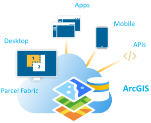
The ArcGIS Parcel Fabric is the modern solution for Land
Administration, designed for any organization in any country
that manages cadastral records. Currently used to manage over 25
million parcels around the world in many countries and land
systems. Extensive global engagement researching best
practices, requirements, and workflows resulted in a
time-tested, purpose-built, LADM compliant solution. With
configurable workflows and localized in many languages, the
Parcel Fabric can be easily configured to meet your organization
specific business requirements.
|
 |
During the free pre-event all attendees will learn to extend the
information model, migrate data and perform record-driven and
quality-driven workflows. The workshop will include demonstrations and
hands-on exercises.
For more information about the programme of the Workshop and
registration please check out our web page:
https://www.fig.net/fig2022/esri_parcel_fabric.htm
For your free registration for the workshop go to:
https://www.fig.net/registrations/regform.asp?eventid=281
About Esri
Esri’s geographic Information system (GIS) technology has given
clients the power to think and plan geographically for over 40 years.
Used today in more than 350,000 organizations worldwide, GIS helps
cities, governments, universities, and Fortune 500 companies save money,
lives, and our environment. GIS helps you understand and question data
in ways that reveal relationships, patterns, and trends. So whether you
are transporting ethanol or studying landslides, you can use GIS to
solve problems and make better decisions,because a GIS enables you to
look at your valuable data in a way that is quickly understood and
easily shared. Esri supports the implementation of GIS technology on the
desktop, servers, online services, and mobile devices.
Read more about the ArcGIS Parcel Fabric:
https://www.esri.com/en-us/arcgis/products/arcgis-parcel-fabric/overview
https://pro.arcgis.com/en/pro-app/2.9/help/data/parcel-editing/whatisparcelfabric.htm
Evelien Hertz - van Gelder July 2022


