History of Surveying and
Measurement
|
Inauguration of a Finnish Point of the Struve Geodetic Arc
World Heritage Monument
Puolakka, Finland, 24 August 2005
|
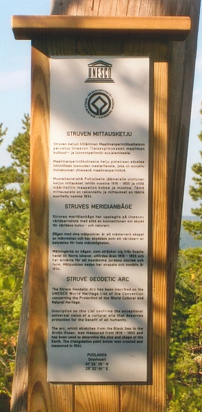
The commemorative plaque unveiled on the site. |
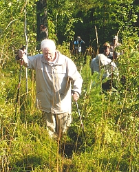
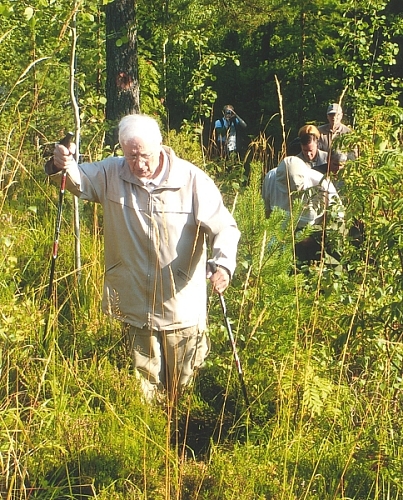
Seppo Härmälä making his way through the vegetation on the climb
to the summit. |
On 24 August 2005 the National Land Survey of Finland organised a
gathering for the inauguration of the survey station at Puolakka as part of
the Struve Geodetic Arc World Heritage Monument. This station is at latitude
61º 55’ 36” N and longitude 25º 32’ 01” E which is some 250 kms north of
Helsinki. The group of some 60 persons that gathered at the point included
representatives from nine of the ten countries involved together with others
from both UNESCO and the FIG International Institution for the History of
Surveying & Measurement; in addition there were local dignitaries from the
nearest town of Korpilahti and several members of press, radio and
television. Some of these had travelled the 250 kms from Helsinki by coach
and then an hour by ferry to reach the vicinity and this was followed by a
steep climb of over 114 m in elevation above the lake to the 192.8 m summit
of the hill.
The idea for such a monument had been first proposed by Aarne Veriö
of Finland to a scientific conference in Tartu in 1993 and the following
year to FIG at its Congress in Melbourne. On both occasions the presentation
was made by Seppo Härmälä, Honorary Member of FIG, who now, at age
87, was able to make his way to the survey station with the rest of the
party and witness the unveiling of an appropriate plaque.
Short presentations were made by Jarmo Ratia, Director General of
the National Land Survey of Finland; Peter Stott of UNESCO and Jan
de Graeve on behalf of FIG.
After taking numerous photographs of the present day survey pillar, the
Struve mark – which is a hole in the rock surface- and of a nearby survey
tower, from which there were superb views over the lakes, the party partook
of suitable liquid refreshment that had somehow mysteriously appeared at the
summit.
All agreed that the National Land Survey of Finland had most suitably
launched the first of the 34 survey stations that formed the substance of
the submission to UNESCO for the successful Inscription as a World Heritage
Monument.
|

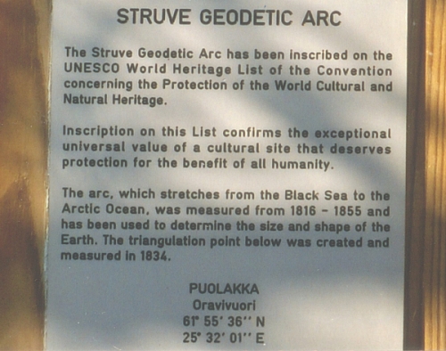
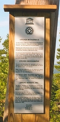
The English version of the inscription. |
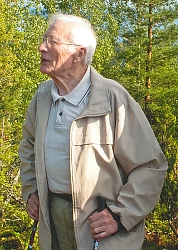
Seppo Härmälä. |
22 September 2005
Jim R Smith
Further information can be obtained from:
Professor Jan de Graeve,
5 Ave de Meysse,
1020 Brussel, Belgium
J R Smith
24 Woodbury Ave, Petersfield
Hants GU32 2EE, UK
e-mail jimsmith1780@gmail.com
National Land Survey of Finland
e-mail pekka.tatila@nls.fi
|