News in 2019
|
Shifting the Paradigm in Africa
Africa Regional Network Meeting 2018
Gaborone, Botswana, 17-19 November 2018
The Botswana Institute of Surveyors hosts:
Africa Regional
Network conference on Geo-Spatial Technology Impacts in Africa, and
The
first Africa Young Surveyors meeting
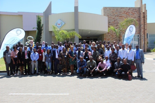
Participants at the ARN Meeting
President Jakoba Kgopolelo of the Botswana Institute of Geomatics
(BIG) led the Annual Africa Regional Network Capacity Development
workshop 17th – 19th October 2018, at the Tlotlo Hotel and conference
Centre in Gaborone, Botswana. With the workshops facilitated by FIG
Vice President Diane Dumashie and partnering with Carsten Bjornsson
(ESRI Southern Africa).
Importantly the conference was preceded by the 1st African Young
Surveyors meeting, that sought to deliberate on their own administrative
issues; but also crucially a one day workshop titled: “Fitting Africa’s
Needs: The Young Surveyors in a Smart World”, coordinated by Kwabena
Asiama, Lore kelvin Sepeetsi, and Sam Kingsley.
The conference focus was on the African Geomatics profession and the
impacts of ever changing geospatial technologies, how they can be
utilised to best contribute to the challenges and opportunities of the
Sustainable Development Goals (SDG’s), particularly addressing Goal 11;
‘Make cities inclusive, safe- resilient and sustainable’.
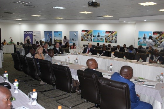
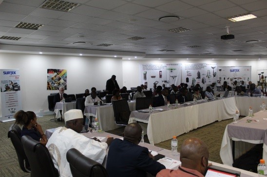
The ARN workshop brought together a record 100 land professionals drawn
from Botswana professional Association and also a range of professionals
from the FIG family from across the continent including a particularly
large contingent from Zimbabwe (great to see you all!), as well as
attendees from West and Southern Africa.
The conference was coordinated by BIG President, Jakoba Kgopolelo,
Lopang Maphale and Olebogeng Molefhi. The afternoon participatory
workshops were designed by Vice President Diane Dumashie who facilitated
the training workshop assisted by Carsten Bjornsson (ESRI Southern
Africa).
A highlight was the opening morning’s key note from the Mr Tshepo
Mophuting the Deputy Permanent Secretary from the Ministry of Land
Management, Water and Sanitation services, he highlighted the important
role of the private sector working with government, emphasising the
government’s ambition to continue to engage. Lopang Maphale acting as
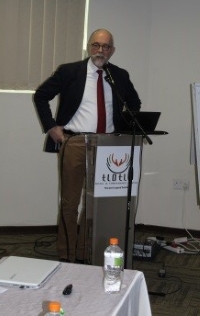
master of ceremonies, introduced key notes from Jakoba Kgopolelo, and
Diane Dumashie [key
note presentation]
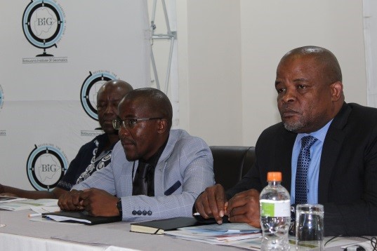
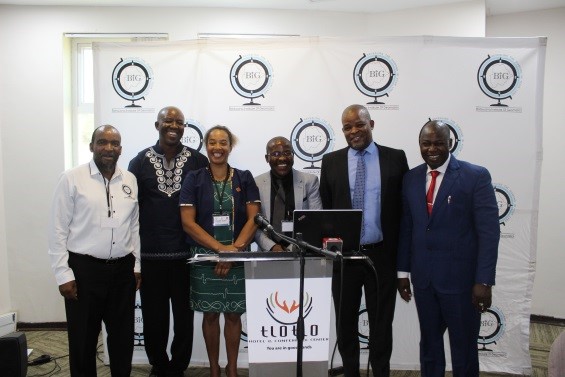
Left Picture: President Jakoba Kgopolelo (BIG), and on his left Mr
Tshepo Mophuting the Deputy Permanent Secretary from the Ministry of
Land Management, Water and Sanitation services. Group Picture on right.
Ultimately we know that as land professionals there is a need to shift
our own paradigm of skills and working; we understand the need to act to
ensure our relevance in the fast changing technological world.
The framework to achieve the deliberations used interactive panel
discussions that stimulated and set the conference scene, complimented
by some remarkable presentations, and followed by participatory
workshop, we explored the need to shift- understood our context-
thought how we engage- and importantly how we may deliver geospatial
technologies.
The conference unfolded with a dynamic plenary session on the role of
African government in advancing Geospatial Technologies that are fit for
purpose. Our panellists: Peter Newmarch, Abednico Maphuru, Carsten
Bjornsson, Chris Williams-Wynn provided a platform for lively debate.
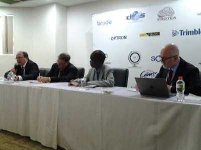
Day 1 Panellist in plenary |
Day 2 Panellist addressing the room in plenary |
In the afternoon group work, we unpacked the question “As a profession
do we do enough to be part of this [smart city] reality?”
With enthusiasm and momentum created from the previous day, the
conference went straight into progressing our deliberations further,
with an opening plenary focusing on shifting the paradigm to develop
African Smart Cities and Communities. The panellist included Diane
Dumashie, Jakoba Kgopolelo, Maje-Maje and Muhammad Mansur Kabir. Who all
provided thought leadership in what it means to develop and plan smart
cities.
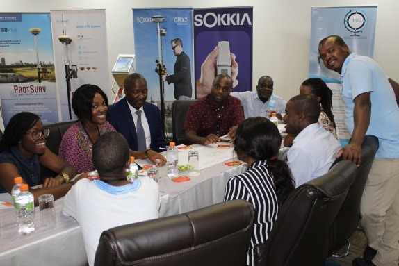
Group work Day 1 & 2
The afternoon workshop sought to
address the second question “What is the shift required in our
profession?
To stimulate our thinking,
Carsten Bjornsson (ESRI Southern Africa) providing a detailed
presentation designed to excite, prompt and engage our thoughts.
Armed with this thought provoking knowledge, in their groups
participants designed ‘rapid’ infographics to illustrate what shift is
required in our profession as it relates to City themes such as
transportation (intelligent road networks, connected cars and public
transport), public utilities (smart electricity, water and gas
distribution), education, health and social care, emergency services,
and public safety. |
Carsten Bjornsson (ESRI Southern Africa) |
The workshop outcome: Engaging and participation is an important design
feature of the ARN workshops, accordingly our deliberation steered us to
the question, “Are we being smart enough, about being smart?
Concluding that we could get better if we ensure
- To be clear in our
messaging and articulating our skills to public and civic society and
also our own professions!
And
- To Keep our skills
relevant with continuous professional development
BIG organised a further day tour to the Department of Surveys and
Mapping (Ministry of Land Management, Water and Sanitation services)
kindly hosted by Abednico Maphuru, Deputy Director. The department staff
generously gave their time to show the group, the Botswana modern
project, LAPCAS (Improvement of Land Administration, Procedures,
Capacity and Systems in Botswana) to see the department structure and
processes, the cadastral information systems and the land information
system plot and Plan module. This was very much appreciated and
interesting.
Over the three days we deliberated, discussed, delved deep into
geospatial technology impacts- to truly question ourselves and the
shifting paradigm that we face. But it was not all work, BIG also
organised play- with an end of conference treat to visit the Mololodi
Nature Reserve where BIG hosted a special traditional braai and a
fantastic sunset game drive to view giraffe, zebra, deer, roe buck and a
tortoise!
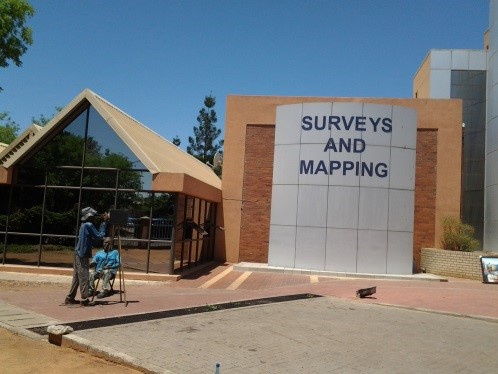
"Department of Surveys and Mapping Entrance |
Abednico Maphuru Deputy Director and Diane Dumashie, Vice
President FIG |

Mololodi Nature Reserve
A big and heartfelt thank you to the Botswana Institute of Geomatics,
they truly held a memorable round up to the 2015- 2018 ARN Term, for
which I and the network are grateful. My sincere thanks to, President
Jakoba Kgopolelo, his team, Molefhi, Lopang, Emma and Lone and those
other behind the scenes with whom we have not met. And sincere thanks
to our corporate member ESRI-Southern Africa who without their support
both financially and with cutting edge content enabled a highly
successful workshop.

President Jakoba presenting Vice President Diane with her gift
The event ended with a welcome to Jennifer Whittal (UCT) as our new ARN
chair, supported by Peter Newmarch (President SAGI). I am pleased
to hand over such a strong network, It has been a wonderful to
make new friends, meet existing friends and make new ones, and I look
forward to seeing it grow from strength to strength.
Full details of this workshop may be found on the
ARN website
Dr Diane Dumashie FRICS
FIG Vice President, Chair Africa FIG Regional Development Network
2015-18
March 2019