News in 2019

|
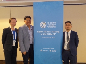
8th Plenary Meeting of UN-GGIM-AP - Asia Pacific Capacity
Development Network Report
3-5 November 2019, Canberra, Australia
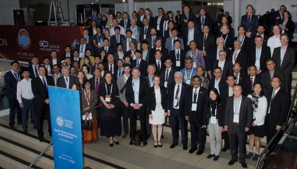
UN GGIM AP Plenary Meeting
The FIG Asia Pacific Capcity Development Network (AP CDN) were
invited by the President of the United Nations Global Geospatial
Information Management for Asia and the Pacific (UN GGIM AP), to
participate in its 8th Plenary Meeting held in Canberra – Australia on
3-5 November 2019. This Plenary Meeting was the first meeting
convened under the Presidency of Australia, and was organised by the
agency Geoscience Australia and also the secretariat, United Nations
Economic and Social Commission for Asia and the Pacific (UN ESCAP), who
are presently based in Bangkok, Thailand.
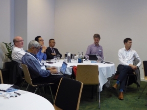
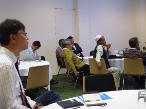
The three-day Plenary Meeting of UN-GGIM-AP was an opportunity for
FIG AP CDN to contribute to the latest discussions pertaining to
geospatial information and UN initiatives such as the Integrated
Geospatial Information Framework (IGIF), Global Geodetic Reference Frame
(GGRF), Framework for Effective Land Administration (FELA), and the
Sendai Framework for Disaster Risk Reduction. Majority of the open and
formal discussions occurred during the first day in the 3 parallel
sessions organised by each of the UN-GGIM-AP working groups to evaluate
their work program and work shop pertinent issues. The 3 working
groups are - Geodetic Reference Frame, Cadastre and Land Management, and
Integrating Geospatial Information and Statistics. Overall there
were almost 100 delegates in attendance at the Plenary Meeting and
workshops; and over 50 reports and presentations were delivered to the
attendees. Note the Plenary Meeting was held prior to the GEO
(Group on Earth Observation) Week 2019, which attracted almost 1200
registrants. GEO website -
https://www.earthobservations.org/geo_community.php
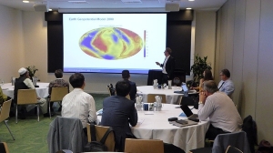
FIG AP CDN provided presentations over the 3 day event. Two of
the presentations were related to the Geodetic Reference Frame working
group and they were -
- Perspectives on Capacity Development & Organisational Planning
for a Modernised Geodetic Framework – presented at the “Positioning
and Datum Modernisation Forum”; and
- Capacity Development Challenges and Opportunities – presented
during the Plenary Meeting Panel Discussion – Geodetic Reference
Frames;
The final presentation was at the GEO side event “Geodesy 4 Sendai”,
and was titled the Role of Surveyors for Disaster Risk Reduction and
Resilience.
Note - copies of the FIG AP CDN presentations are available upon
request and / or can be sourced from the UN GGIM AP 8th Plenary Meeting
website.
As per previous UN GGIM AP meetings, members of each UN GGIM AP work
group reviewed the main issues or points arising from sessions or
discussions, and subsequently developed resolutions for consideration by
the attendees of the Plenary Meeting. UN GGIM AP Working Group 1 -
Geodetic Reference Frame, with assistance from FIG AP CDN, and
representatives from the United Nations Sub-Committee on Geodesy
Education Training and Capcity Building (UN SCoG ETCB) formed statements
involving geodetic datum and reference frame matters, such as
recognising the -
- importance of modernising datum, and positioning
infrastructure;
- benefits of continued collaboration and capacity development;
and the
- challenges associated with geodetic data sharing, formalizing
collaboration, and contributing to better disaster risk reduction
management and resilience.
In light of the above, the following were recommended, to the Plenary
Meeting attendees for adoption –
UN GGIM AP Members -
- Contribute to the Global Geodetic Reference Frame through close
collaboration with the Subcommittee on Geodesy and its Working
Groups;
- Support the adoption of the International Terrestrial Reference
Frame by participating in regional geodetic programs such as the
Asia-Pacific Regional Reference Frame (APREF) and the Asia Pacific
Regional Geodetic Project (APRGP);
- Support the observation, analysis and development of national
GNSS, Satellite Laser Ranging (SLR) and Very Long Baseline
Interferometry (VLBI) infrastructure and their interconnection for
reference frame improvement and provide an Asia and Pacific
perspective to the global geodetic community;
- Work with organizations such as the International Federation of
Surveyors (FIG) and the International Association of Geodesy (IAG)
to develop common approaches to geodesy;
- Strongly encourage Member States to share geodetic data openly
and freely to support for example the connection of national height
datums to global systems so that decision makers can address global
issues such as sea level change through the use of global and
regional products and services;
- Encourage Member States to consider sharing real-time geodetic
observations to support disaster risk reduction;
- Encourage Member States to modernize data sharing legislations
and policies to allow open and free geodetic data sharing, and
implement them so as to support the realization and maintenance of
sustainable national, regional and global geodetic reference frames;
- Encourage technical capability development through training and
cooperation in GNSS data processing, geoid determination,
development of regional height systems, connection of sea and land
based vertical reference surfaces, the use of open geodetic software
and the sharing of best practice examples and use cases; and
- Support geodetic experts from Member States to attend
appropriate regional forums, such as the relevant working group
meetings of the UN-GGIM-AP.
For the resolutions adopted by the other working groups (i.e. Land
Management), and also the official summary of the Plenary Meeting please
refer to UN GGIM AP website -
https://www.un-ggim-ap.org/meetings/pm/8th/201911/8thPlenary.shtml
With respect to the “Geodesy 4 Sendai” meeting, it is apparent the
Disaster Resilience section of the GEO (Group on Earth Observation)
organisation is forming a group of various geospatial information
professionals, scientists and interested stakeholders or community
groups to collaboratively address the better operations of early warning
systems, reducing disaster risk and building resilience to disasters.
From a broader perspective it appears GEO is seeking assistance from FIG
(and other related agencies such as UN-GGIM-AP) to address the four
priority actions of the Sendai Framework Disaster Risk Reduction, which
are –
- Understanding disaster risk;
- Strengthening disaster risk governance to manage disaster risk;
- Investing in disaster risk reduction for resilience;
- Enhancing disaster preparedness or effective response, and to
“build back better” in recovery; rehabilitation and reconstruction.
During the presentation and meeting it was emphasised that the Sendai
action agenda was very recognisable to FIG and its Commissions, as they
had dealt which such matters through various task forces, publications
and work plans.
Another interesting initiative conveyed at the Plenary Meeting was
the presentation on the creation of a Global Geodetic Centre of
Excellence (GGCoE) under the auspices of the UN. The presentation on
this initiative was delivered by Mr Nicholas Brown, who is now the Co-
Chair of the UN SCoG as Mr Gary Johnston has retired. Mr Brown
stated that the Member States of UN Committee of Experts on GGIM had
“commended” the proposal at their August 2019 meeting, and that they
were now seeking views (through the UN SCoG) on how the GGCoE may
operate; what their work program might comprise of; structure and
composition of governance and institutional arrangements; and the role /
responsibilities of the GGCoE, donor (resourcing) agencies and
stakeholders.
The UN SCoG have also recognised the importance of collaboration to
establish GGCoE, with both the scientific sector (i.e International
Association of Geodesy – IAG) and professional surveying or operational
organisations, such as the FIG and the survey mapping agencies of UN
Member States. From an FIG AP CDN and Commission 5
perspective, although attempts to build geodetic and geospatial
information capability have been somewhat successful, the current
framework and mechanisms to support capacity development in geodesy or
geospatial information management are not sustainable. Looking at a
broader assessment and into the future, for FIG to deliver or assist
with professional development at the individual, organisational and
regional / global level, the development of GGCoE may be one of the
strategic pathways to consider.
Presently, the next meeting on this subject is scheduled for the
UN-GGIM High Level Forum in Windsor - Unted Kingdom, April 2020, where
discussions on the development and implementations on the role, work
program and governance of a GGCoE will take place. Consequently,
it is suggested that the FIG President and / or Council member(s) have
an opportunity to comment on the GGCoE initiative, either prior to this
meeting or possibly at the meeting, then they should consider expressing
the following to the UN SCoG for their consideration –
- Formulate the objectives of the GGCoE to focus on the
facilitation, discovery, delivery and dissemination of geodetic
competencies, practices or techniques and capabilities for the
sustainable operations of geodetic infrastructure and systems.
In other words effective, efficient and equitable mechanisms for
knowledge management and development.
- Facilitate more constructive and focused engagement with the
Academic and Corporate (commercial) sector in regards to their
potential contribution to and involvement in a GGCoE. For
example recognised academic institutions could assist with the
development of curricula for core competencies, offer short courses
or their facilities to assist with capacity development programs;
and corporate partners could provide specific training on
applications or supply relevant technological innovate expertise and
possibly equipment.
- Seek advice from the information technology sector on
establishing GGCoE, in particular – defining the strategy, vision
and scope; securing and formalising funding and resources;
staff selection and employment; advocating or marketing the
importance and benefits; identifying factors that influence the
location and choice of a headquarters (central bureau), and
educational / training facilities; developing streamlined and clear
governance / institutional arrangements between governments (and
internal agencies), commercial sector, academia, and the scientific
and professional surveying community; and performance / monitoring
measures.
- Clearly defining the purpose to ensure that the GGCoE does not
evolve into either a research and development centre or becomes a
mechanism to exclusively resource the operations of a local agency
and its’ geodetic infrastructure.
- Using established organisations and their facilities to deliver
education and training on specialised or priority aspects of
geodesy. For example - using existing International GNSS
Service data analysis centres once they are accomplished to deliver
the required education / training; supporting countries or regional
bodies to share experiences on developing and implementing
geospatial information organisational or capacity development plans.
- Utilising the information discovered and evaluation reports
prepared by existing capacity development networks, programs or
initiatives. For example reports on the geodetic and geospatial
challenges being faced by Member States, the required core geodetic
capabilities, both technical and “soft”, required for sustainable
development, and who can provide assistance with capacity
development.
In concluding, please note the upcoming events for both FIG AP CDN
and Commission members to consider participating in and attending -
If you are interested in the upcoming events and require more
information please contact Rob Sarib –
rob.sarib@gmail.com or
navigate to the relevant website.
Positioning and Datum Modernisation Forum
Rob Sarib, Chair FIG AP CDN
November 2019