Plenary Speakers
- Opening Ceremony
- Congress Keynote
- Plenary Session 1 - Monday - FIG Achievements for 2007-2010
- Plenary Session 2 - Tuesday - Spatially Enabled Society
- Plenary Session 3 - Wednesday - The Big Challenges
- Plenary Session 4 - Thursday - Technological Futures
- Tuesday after lunch talk - Data Management Framework Using GIS
- Wednesday after lunch talk - The Fourth Wave of Property Reform
- Thursday after lunch talk - Surveying in the Year 2020
Opening Ceremony
The congress opening session will provide a spectacular introduction to congress, its theme, and its unique location. Formal welcome addresses will be given in balance with more entertaining features.
Participants and accompanying persons will enjoy an attractive opening of a week fully packed with professional presentations and discussions as well as social events and technical tours. The key attraction of the opening session is of course the congress keynote that deals with one of the key challenges of our times.
Congress Keynote
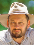 Tim Flannery
The Congress Keynote will be presented by Professor Tim Flannery, who is one of Australia’s leading thinkers, an internationally acclaimed scientist and conservationist and 2007 Australian of the Year. In line with our Congress theme of “Facing the Challenges”, Tim will speak about Climate Change; one of the greatest challenges facing our world and our Profession in the 21st Century.
For his keynote presentation Tim will draw on ideas from his groundbreaking book, “The Weather Makers: How Man Is Changing the Climate and What It Means for Life on Earth”, which debuted on The New York Times bestseller list. Tim will explore the connection between climate change, global warming, and human activity. He will also lay out a game plan for halting current warming trends and beginning to reverse the damage we have done. Tim has said that his goal is to mobilize his listeners “both personally and politically” to recognize that we are all “weather makers” and that the only choice, both logically and ethically, is to face this challenge before it’s too late.
Tim Flannery is a former director of the South Australian Museum, and is currently a professor at Sydney’s Macquarie University. He spent a year as professor of Australian studies at Harvard, where he taught in the Department of Organismic and Evolutionary Biology. In 2002, he became the first environmentalist to deliver The Australia Day address to the nation. In 2005 he was honoured as Australian Humanist of the Year and, in 2007, he was named Australian of the Year.
Plenary Session 1 - Monday - FIG Achievements for 2007-2010
The Congress marks the culmination of the four-year Work Plans
of the FIG Council and the 10 FIG Commissions. This first Plenary
Session will take stock of that work through a keynote presentation
of the FIG President as well as invited presentations by selected FIG
office bearers. The session will profile the work of the FIG Council,
Commissions, and Task Forces, and highlight particular achievements
such as seminal workshops, agreements, declarations and publications.
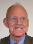 Stig Enemark
The FIG President Stig Enemark will present the overall achievements
of FIG for 2007-2010 in relation to the FIG work plan and the policies
of the FIG Council. The role of FIG in both “flying high” and also
keeping the “feet on the ground” will be explained through a range
of examples and activities that have increased the standing of the
surveying profession world wide. This can influence the global agenda
and at the same time provide interesting opportunities for member
associations and individual surveyors at national level.
Stig Enemark is President of FIG. He is Professor in Land Management
and Problem Based Learning at Aalborg University, Denmark, where
he was Head of School of Surveying and Planning 1991-2005. He has
been substantially involved in the Danish Association of Chartered
Surveyors (DdL) being President 2003-2006, and he chaired the FIG
Commission 2 on Professional Education 1994-1998. He is an honorary
member of both DdL and FIG.
He is a well know international expert in the areas of land administration systems, land management and spatial planning, and related educational and capacity building issues. He has published widely in these areas and undertaken consultancies for the EU and World Bank especially in Eastern Europe and Sub Saharan Africa.
Plenary Session 2 - Tuesday - Spatially Enabled Society
The second plenary session will examine the accelerating trend towards a more spatially enabled society and what that means for our Profession. The topic will be addressed by three internationally recognised keynote speakers addressing topics ranging from the global perspective to what spatial enablement means in two quite different region of the planet, Latin America and Australasia.
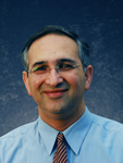 Abbas Rajabifard
Abbas Rajabifard will draw on his experience as President of the Global Spatial Data Infrastructure (GSDI) Association to speak on issues facing the profession globally, as we move towards a Spatially Enabled Society.
Dr Abbas Rajabifard is an Associate Professor
and Director of the Centre for Spatial Data
Infrastructures and Land Administration at
the Department of Geomatics, the University
of Melbourne. He is President of the GSDI
Association, and has been a driving force
within the UN supported Permanent
Committee on GIS Infrastructure for Asia and
the Pacific (PCG IAP). His research interests
include the design and development of
SDIs in different jurisdictions, benchmarking
worldwide cadastral systems and
administration and SDI in marine areas.. He
has also consulted widely to many national
government agencies and ministries.
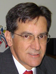 Santiago Borrero
Santiago Borrero is Secretary General of the Pan American Institute of Geography and History (PAIGH) and will outline some of the key challenges being faced by administrators in the Latin American Region as they work to build Spatial Enabled Government.
Born in Bogotá, Colombia, Santiago graduated from MIT in 1977. He has more than 28 years of experience in Information and Development, mainly in the production and application of spatial information to land administration and governance and the strategic value of geographic information for developing nations. Santiago is well known and respected internationally, where he has chaired the Global Spatial Data Infrastructure (GSDI) Association, the Permanent Committee on SDI for the Americas (PC-IDEA) and the PAIGH Cartographic Commission. During his career In Colombia, he has been Director General of the “Agustin Codazzi” National Geographic Institute (1994-2002).
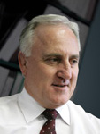 Warwick Watkins
The third invited presentation in this Plenary
Session gives a local perspective on how
spatial enabled government is facilitated in
the State of New South Wales and the region
of Australia and New Zealand. The focus is on
making spatial information easily accessible
to government, business and citizens. This
will be delivered by Warwick Watkins, the
Chair of the Australian and New Zealand Land
Information Council (ANZLIC).
As well as his role in ANZLIC, Warwick is the Director General of the Department of Lands in New South Wales (NSW), where he is also the Surveyor General, the Registrar General and the Commissioner of the Soil Conservation Service. His Department has a broad set of responsibilities including Land and Property Information, administration and management of Crown Lands, Native Title and Aboriginal Land Claims, Soil Conservation Service, Land Boards, the Emergency Information Coordination Unit, the Office of Rural Affairs and the Office of Biofuels. Warwick has received a number of awards and is an Honorary Fellow of the Institution of Surveyors.
Plenary Session 3 - Wednesday - The Big Challenges
The third Plenary Session will further develop the Congress theme of “Facing the Challenges”. Three internationally recognised keynote speakers will explore in detail three of the Big Challenges of the 21st Century and their relevance to our Profession namely Climate Change, Disaster Management and Land Governance.
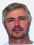 Daniel Fitzpatrick
Daniel Fitzpatrick will speak about another of our Big Challenges, Disaster Management. In his presentation entitled “From Vulnerability to Resilience: Addressing Land Issues after Natural Disasters”, Daniel will outline the new UN guidelines on addressing land issues after natural disasters (UN HABITAT and FAO). His presentation will focus on developing country land systems that are vulnerable to natural disasters because of poor land use planning and weak land administration systems. His presentation will use the Indonesian tsunami as a case-study.
Dr. Daniel Fitzpatrick is a Reader in Law at the Australian National University. He was the UN’s land rights adviser for tsunami-affected Indonesia (2005-6). Currently he is finalizing the UN’s Guidelines on Addressing Land Issues after Natural Disasters. He has been a Visiting Professor at the University of Muenster and the National University of Singapore, and a Distinguished Visitor at the University of Toronto.
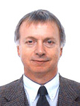 Paul Munro-Faure
The second speaker in this Plenary Session will be Dr. Paul Munro-Faure from the Food and Agriculture Organization (FAO). Paul will speak on the crucial role played by Good Land Governance in the work of FAO. The focus will be on the current development of Voluntary Guidelines on Responsible Governance of Tenure of Land and Natural Resources.
Dr. Paul Munro-Faure is Chief of the Land Tenure and Management Unit of the Food and Agriculture Organization (FAO) based in Rome. He is a Chartered Surveyor with qualifications in land management, rural planning and public sector land management, with extensive practical experience in the agricultural and urban sectors in the developed market economies, in the transitional economies of Central and Eastern Europe and the CIS, in the Asia/Pacific region and in Africa. He has been substantially involved in the UK’s Royal Institution of Chartered Surveyors and chaired the International Federation of Surveyors’ (FIG) Commission 7 on Cadastre and Land Management 1998-2002.
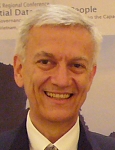 Mohamed El-Sioufi
The final speaker in the third Plenary Session is Dr. Mohamed El-Sioufi from UN-HABITAT (The United Nations Human Settlements Programme). He will speak about Climate Change and Sustainable Cities: major challenges facing cities and urban settlements in the coming decades.
Dr. Mohamed El-Sioufi is the Head of the Shelter Branch in UN-HABITAT. He has 32 years of experience in architecture, housing and urban planning. His experience bridges professional practice, academia, research, training and technical advice. He has worked for UN-HABITAT since 1995 in training and capacity building, policy and technical cooperation and the development of global norms and guidelines. His experience in human settlement spans a variety of specialized fields including capacity building in sustainable urban development including historic cores, housing policy and strategies, slum upgrading, climate change mitigation through sustainable building materials and construction technologies, post disaster rehabilitation, environmental planning and management.
Plenary Session 4 - Thursday - Technological Futures
The final Plenary Session for the Congress will take a look into the future, including the technologies that will influence our profession as we move into the second decade of the 21st Century. This glimpse into the future will be described from three quite diverse perspectives, an eminent scientist, a commercial technology evangelist and a custodian of public infrastructure.
 Mary O'Kane
Mary O’Kane is the Chief Scientist for New South Wales and will draw on her experience in two recent reviews by the Australian Government into the important roles played by Research and Science in modern Australian society. Mary is especially well qualified to put these issues into the context of our Profession, based on her role as Chair of Australia’s Cooperative Research Centre for Spatial Information.
Mary is a specialist in high technology commercialisation, national and international research strategy and higher education policy and is Executive Chairman of Mary O’Kane & Associates Pty Ltd, a Sydney-based company that advises governments, universities and the private sector on innovation, research, education and development. Professor O’Kane was Vice-Chancellor of the University of Adelaide from 1996-2001 and Deputy Vice-Chancellor (Research) from 1994-96. She was also Professor of Electrical and Electronic Engineering within the University. Professor O’Kane serves on a number of boards and committees in the public and private sectors. She is Chair of the Australasian CRC for Interaction Design.
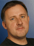 Ed Parsons
Ed Parsons is Google’s Geospatial Technologist
for Europe, Middle East and Africa and a
driving force in the development of Google’s
geospatial technologies. Ed will outline his
vision for evangelizing Google’s mission
to organize the world’s information using
geography, and tools including Google Earth,
Google Maps and Google Maps for Mobile.
Ed Parsons is Geospatial Technologist at Google Inc and is also a Founder of Open Geomatics, a strategic consultancy focused on geospatial technology tracking and neogeography. Ed joined Google following his role as Chief Technology officer at the Ordnance Survey of Great Britain. While at OSGB, he set the strategic direction in Information Technology and specifically GeoSpatial data management. Before joining Ordnance Survey, Ed was EMEA GIS Applications Manager at Autodesk and prior to that a Senior Lecturer at Kingston University.
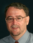 Matt Higgins
The final presentation in this Plenary Session will be given by FIG Vice President, Matt Higgins. Matt represents FIG in the UN mandated International Committee on Global Navigation Satellite Systems and will speak on the rapidly developing area of positioning technology, the move towards ubiquitous positioning infrastructure and the implications for FIG members.
Matt Higgins is Principal Survey Advisor
with the Department of Natural Resources
and Water in the Queensland Government
in Australia. He holds Bachelor and Masters
Degrees in Surveying. Through his role as FIG
Vice President, Matt represents the Federation
on the UN mandated International Committee
on GN SS. In May 2008, GPS World magazine
named Matt in the 50+ leaders to watch in
GN SS business. Also in 2008, Matt was elected
President of the Australian based International
GN SS (IGN SS) Society. At the 2005 Asia-Pacific
Spatial Excellence Awards, Matt received
the award for “Professional Eminence and
Excellence in the Spatial Sciences”. The award
is the SSI’s highest form of recognition for
professional eminence.
Tuesday after lunch talk - Data Management Framework Using GIS
Information is increasingly accessible and integrated, as such we all need systems that allow this information to be better managed and exploited over time. We cannot imagine how this data maybe used in 10 years, so data management and integration is increasingly important to protect and grow the valuable data asset. Geographic information must be understood in relation to what’s around it in space and in time in order to provide the best possible tools for planning and building our communities into the future. GIS plays a critical role in providing an integrated framework for leveraging this information in all land administration functions. This talk will discuss how the changing patterns of use and the expected patterns of use have transformed geographic data, and how GIS becomes the framework to make this data manageable, useful and meaningful, extracting its full value.
 Damian Spangrud
Damian Spangrud is the Senior ArcGIS Product Manager at ESRI. In this role Damian has helped direct the product releases around ESRI’s ArcGIS product line for the last 15 years. Damian has a MSc in Earth Science from Montana State University, and has participated in numerous design, analysis and cartographic projects around the globe. His vision and insight on the direction of geospatial technology is well recognized throughout the industry.
Wednesday after lunch talk - The Fourth Wave of Property Reform
This presentation will provide a retrospective look at international property reform over the past six decades, both from an economic and social perspective and from the perspective of the professional land administrator. It will then examine some of the emerging challenges and trends.
The First Wave of Property Reform after the Second World War occurred largely in South-east Asia, was concentrated in Japan, Taiwan and South Korea, and was largely based on institutions and structures imported from the West in order to change the existing political and militaristic culture. The Second Wave of Property Reform, with its strong ideological flavour, was a phenomenon of the land reform movements that peaked in the mid-60s. It was based largely in South America and elsewhere in order to address major inequities in land access, and peaked in the mid-1960s. Twenty years later the Third Wave of Property Reform emerged under different guises in a large number of jurisdictions including Russia, Estonia, Thailand, Peru and South Africa. This was fuelled in part by a renewed interest in the importance of institutions to development and by new technology imperatives. In each wave lessons were learned and progress made, but as well limits were tested and failure was widespread - serious problems remain.
Now a Fourth Wave of Property Reform is just emerging. It will differ from all previous “waves” in a variety of predictable and not so predictable ways. It will occur everywhere property reform has occurred previously and will be much slower to be adopted. It will cost more in time and effort to implement and it will be more difficult to manage since there is now a strong realization that context is critical, and that property reform is unsustainable without addressing the context. The new contextual issues include a global drive to meet the Millennium Development Goals, a rising middle class and civil society, a much stronger environmental consciousness related to climate change and land degradation, an appreciation that culture matters, and a commitment to improved governance as a foundation for development.
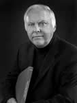 John McLaughlin
John McLaughlin is a Professor of Geomatics Engineering at the University of New Brunswick. After serving as the University’s 17th President and Vice-Chancellor, he was appointed President Emeritus in 2009.
Professor McLaughlin spent much of his academic and professional career as a leader in building the North American geomatics industry. He also worked extensively overseas in more than forty countries on the development of property systems with the World Bank, UNDP and many other international organizations. He has authored or co-authored more than two hundred publications.
Dr. McLaughlin has been recognized as one of Atlantic Canada's top CEO's by Atlantic Business Magazine. In 2007 he received the Lieutenant Governor's Award for Excellence in Public Administration and in 2009 he was installed as a member of the Order of New Brunswick.
Thursday after lunch talk - Surveying in the Year 2020
The last 20 years have seen enormous changes in the way modern survey work is conducted, triggered by astonishing advancements in product development, which are based on new technologies like GNSS, wireless communication, electronics and software in general. Not only have the products changed, but also the people using the products, who have often not undergone a proper education in surveying. Instrument manufacturers like Leica Geosystems are an integral part of this continuous change process which every professional surveyor is experiencing. The question which is of equal interest to the professional surveyor as well as to a surveying instrument manufacturer is how surveying products and surveying workflows might change in the coming ten years. This question will be discussed primarily from a product and technology point of view.
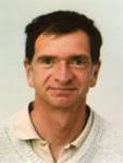 Johannes Schwarz
Johannes Schwarz is President of the Geomatics Division of Leica Geosystems. As such, he is responsible for all surveying products of Leica. Johannes has been with Leica Geosystems in Switzerland for the past 21 years, where he served in various functions of Product Management and Product Development. Before joining Leica, he studied Geodesy and Geomatics Engineering at the Technical University of Vienna. After finishing University, he worked as a lecturer at the University, as well as a land-surveyor in Austria.


