On each conference days a plenary session is planned, each with three inspiring, high level presentations that will highlight current challenges and focus areas within the overall theme Surveying the world to tomorrow - From digitalisation to augmented reality. The three sessions will be:
TUESDAY 30 MAY 2017 |
|
Theme: Living of Tomorrow – In a Digitalised World |
|
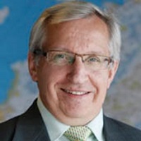
Mr. Arvo Kokkonen
|
|
|
Arvo Kokkonen is a surveyor employed by the National Land Survey of
Finland (NLS) for nearly 30 years. Mr. Kokkonen has held many different
positions like Chief District Surveyor and Deputy Director General. He
has also worked as Survey Counsellor in the Ministry of Agriculture and
Forestry for nearly two years and as cadastral surveyor in the town of
Haapajärvi for five years. He was appointed Director General of the NLS
from September 1, 2012. Mr. Kokkonen has also worked in international
projects and organizations, e.g. being member of UNECE Working Party on
Land Administration and EULIS. Likewise, he has participated in the
activities of EuroGeographics, PCC, UN-GGIM and FIG. |
|
Mr. Greg Bentley
|
|
|
Greg joined his four brothers at Bentley Systems in 1991. Previously, he founded a financial trading software firm, which became part of SunGard Data Systems, Inc., an S&P 500 company on whose public-company board Greg served from 1991 through 2005. He holds an M.B.A. in finance and decision sciences from Wharton. Greg is a trustee of Drexel University, where he also serves as chairman of the advisory board for the Pennoni Honors College, and a trustee of the National Building Museum. |
|
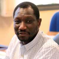
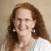
Mr. Oumar Sylla
|
|
|
Mr. Oumar Sylla is the Land and GLTN Unit Leader within the Urban Land Legislation and Governance (ULLG) branch at UN Habitat effective 14th of September 2015. He is greatly experienced, both academic and practical, in land governance, natural resources, conflict resolution, and urban development and planning, urban safety and security, slum upgrading, regional cooperation and partnerships. Prior to joining Land and GLTN Unit, Oumar served as a Senior Advisor in UN-Habitat’s Regional Office for Africa where, among other things, he coordinated a regional program to strengthen the capacity of member states in the Great Lakes Region to deal with land and property issues related to displaced persons in support to the International Conference of the Great Lakes Region secretariat and to the Peace and Stability Framework for the Great Lakes Region. Before that, he supported implementation of the GLTN programme and managed UN-Habitat land program in Democratic Republic of Congo in a peace building context as Chief Technical Advisor. He also has experience on the European Union framework, which he gained as a Land Policy Advisor in South Sudan and Burkina Faso. In addition he served as a Researcher Fellow within the Laboratory of Legal Anthropology in Paris 1 Sorbonne, mainly working on land and decentralization policies in West Africa. |
|
WEDNESDAY 31 MAY 2017 |
|
Theme: Professional behaviour – In a Digitalised World |
|
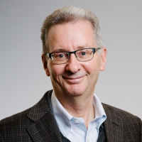
Mr. Robert Guinness
|
|
Mr. Guinness is a Research
Manager and leader of the “Intelligent Mobility and Geospatial
Computing” research group in the Department of Navigation and
Positioning of the Finnish Geospatial Research Institute, part
of the National Land Survey of Finland. He holds a bachelor
degree in physics from Washington University in St. Louis and a
master degree in space studies from the International Space
University in Strasbourg. He began his career at NASA in
Houston, Texas before entering the field of navigation research
in 2010. In 2014, he co-authored the book “Geospatial Computing
in Mobile Devices,” published by Artech House. His doctoral
thesis, published in 2015, was titled “Context Awareness for
Navigation Applications.” His current research interests include
privacy-preserving location technologies and analysis of
crowdsourced geospatial data. Since 2015, he leads the
MyGeoTrust project which is focused on these two topic areas.
|
|
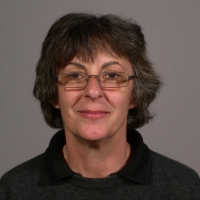
Prof. Yola Georgiadou
|
|
|
Yola is professor in geo-information for governance at the Faculty of Geo-Information Science and Earth Observation (ITC) of the University of Twente. She is past member of the Board of the GSDI Association (representing academia), of the Capacity Building Working Group of CODI-Geo, United Nations Economic Commission of Africa and of Executive Committee of the International Society of Digital Earth (ISDE). She is member of the NCG sub-commission on SDI in the Netherlands, of the editorial board of the Journal Information Technology for Development (JITD), the International Journal of SDI Research (IJSDIR) and the International Journal of Digital Earth (IJDE). Her research is at the interface of geo-information technology, policy and global development. Her current studies include how people enact, organize, and institutionalize (or not) geo-information technology in various policy domains (water, environment, urban and land) and how the informational, social and material underpinning of human action (i.e. infrastructure) is built, maintained and breaks down. Her methods are qualitative. Her normative orientation is “working with the grain” of institutions and organizations in the global South. Yola was collaborator in the research program 'Linking local
action to international climate agreements in the tropical dry
forests of Mexico’, and in ‘Using spatial information
infrastructure in urban governance networks in Indian cities’.
She is leader of the research program ‘Sensors, Empowerment, and
Accountability in Tanzania (SEMA)’. The three programs are
funded by the Netherlands Organization for Scientific Research —
Science for Global Development (NWO-WOTRO). |
|
Dr. Jolyne Sanjak
|
|
|
Dr. Jolyne Sanjak is an agricultural economist with specialization in development economics. She has more than 30 years of experience related to inclusive global economic development. Her principle expertise areas include rural and urban land governance, rural livelihoods and agricultural development. Currently serving as Landesa’s Chief Program Officer, she provides strategic leadership, oversight and technical support to Landesa’s programmatic work worldwide. Prior to joining Landesa, Dr. Sanjak founded and was the Executive Director of the Land Alliance, a not-for-profit organization engaged in supporting land-based development around the globe. She served the Millennium Challenge Corporation (MCC) as Deputy Vice President for the Technical Services Division and in other roles before that. At the MCC , Jolyne lead teams working on private sector development, agriculture, land tenure, gender and social assessment, health, education, and community development, fiscal accountability, procurement, economics and monitoring and evaluation. She also helped shape MCC strategic direction and policy. She has served as a lead for the United States government in
intergovernmental negotiations including the United Nations Food
and Agriculture Organization’s Voluntary Guidelines on the
Responsible Governance of the Tenure of Land, Fisheries, and
Forests in the context of National Food Security (VGGT). Her
earlier professional experiences include being an
Assistant Professor of Economics, joint with Latin American
Studies and a land tenure consultant for the World Bank, IFPRI,
the FAO and the IADB with specialized expertise in land markets,
land tenure, land policy, property registration, agricultural
productivity and gender and impact evaluation. |
|
THURSDAY 1 JUNE 2017 |
|
Theme: The Contribution of our Profession – In a Digitalised World |
|
Prof. Markku Poutanen
|
|
|
Professor, PhD Markku Poutanen is the Director of the Department of Geodesy and Geodynamics, Finnish Geospatial Research Institute (FGI), National Land Survey of Finland. He has been working in the FGI since 1985 on satellite geodesy and positioning, reference frames and metrology. He has an Associate professorship in two universities. Poutanen is the current president of EUREF, commission of the European Reference Frames. He is chairing the United Nations Committee of Experts on Global Geospatial Information management in Europe (UN-GGIM: Europe) working group of Geodetic reference frame in Europe (GRF: Europe). He has been the president of the European Geosciences Union (EGU) Geodesy Division, president of the International Association of Geodesy (IAG) sub-commission 3.2 Crustal Deformations and is a member of several National Committees related to ICSU (International Council for Science), and currently chairing the National Committee of IUGG (International Union of Geodesy and Geophysics). Poutanen has more than 250 scientific and popular articles
and he is author, co-author and editor of university-level text
books and popular books on astronomy and geodesy. Asteroid 3760
Poutanen is named after him. He is a full member of the Finnish
Academy of Science and Letters. |
|
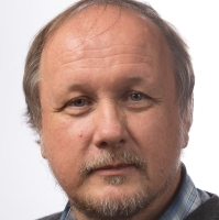
Mr. Fredrik Zetterquist
|
|
|
Mr. Fredrik Zetterquist is the Managing Director of
Swedesurvey, the state-owned overseas agency of Lantmäteriet,
the Swedish national mapping, cadastral and land registration
authority. Since the beginning of the 1980s Swedesurvey has
exported the competences and experience of Lantmäteriet
throughout the world and as part of the Swedish government’s
Policy for Global Development. Mr. Zetterquist has an MSc in
Geodesy and Photogrammetry. After his studies he worked as
lecturer in cadastral surveying and mapping during four years
and was then employed by Swedesurvey in 1994, responsible for
establishment of a Land Management Department at the University
of Novgorod, Russia. After his return to Sweden in 1996, and
until 2008, he worked as adviser and project manager in numerous
long-term international land administration and capacity
development projects, especially in Eastern Europe. Between 1996
and 1998 he did part-time PhD studies in 3D city modelling. Mr.
Zetterquist also founded a company to conduct due diligence on
land-related matters. Between 2008 and 2011 he was as Deputy
Director instrumental in bringing up a large-scale farm
enterprise in Russia, strictly in compliance with the World
Bank’s social, ethical, environmental and legal performance
indicators. Mr. Zetterquist was in 2012 appointed his current
position as Managing Director at Swedesurvey. In March 2017 he
was elected as Chair at the UN-ECE Working Party for Land
Administration.
|
|
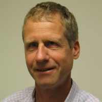
Prof. Juha Hyyppä
|
|
|
Juha Hyyppä has over 400 scientific and technical papers (85 ISI, 120+ journal, 200 full-paper reviewed) on remote sensing, especially in the field of laser scanning, radar and point cloud processing. The recognitions he has received include ISPRS President’s Citation 2008, ASPRS second best paper in PERS (2009), Innovation Award (2010) and recognition from MWP Symposium in 2011. He has been Editor/Guest Editor of several journals, including ISPRS Journal of Photogrammetry and RS, Centenary Celebration Issue, MDPI Remote Sensing on LS and Forestry Special Issue, and MLS Special issue. |
|
|
Tuesday 30 May |
Wednesday 31 May |
Thursday 1 June |
 |
 |
|
| 9.00-10.30 | Opening Ceremony | Plenary Session | Plenary Session | ||
| 10.30-11.00 | Coffee/tea
Break Exhibition opens |
Coffee/tea Break | Coffee/tea Break | ||
| 11.00-12.30 | Plenary Session | 10 parallel Technical Sessions | 10 parallel Technical Sessions |
 #FIG2017 |